Cabin Price
Start at $291
Departure
Ushuaia & Longyearbyen & Iceland & Greenland
Destination/Type
Antarctica & Arctic Liveaboard
Highlights:
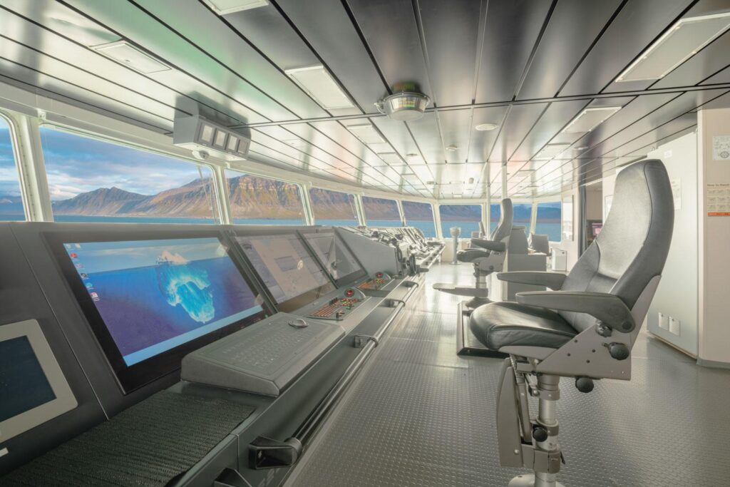
The 4 Ships of Oceanwide Expeditions:
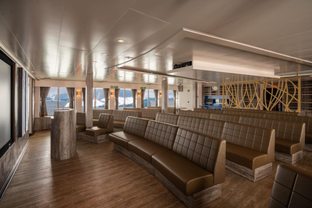
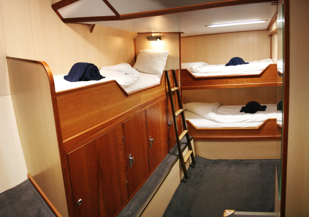
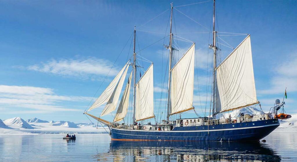
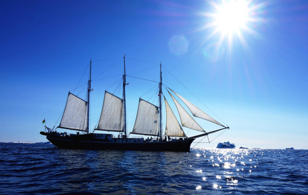
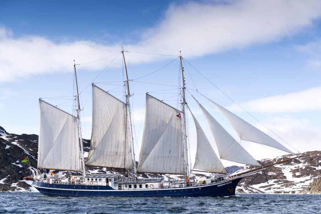
S/V Rembrandt Van Rijn (NO DIVING)
S/V Rembrandt Van Rijn was originally built as a herring lugger. The vessel was rebuilt as a three-masted passenger sailing schooner in The Netherlands in 1994 and sailed in Spitsbergen (1994 – 1996) and in Galápagos (1998 - 2001). The vessel underwent a complete rebuilding and refurbishment program in 2011. The communication and navigation equipment has been completely renewed according to the latest SOLAS regulations. The ship is well suited for expedition cruising among small islands and offers excellent open deck viewing areas, even when under sail. The two inflatable rubber crafts (zodiacs) enable landing and wildlife viewing opportunities in otherwise inaccessible areas.
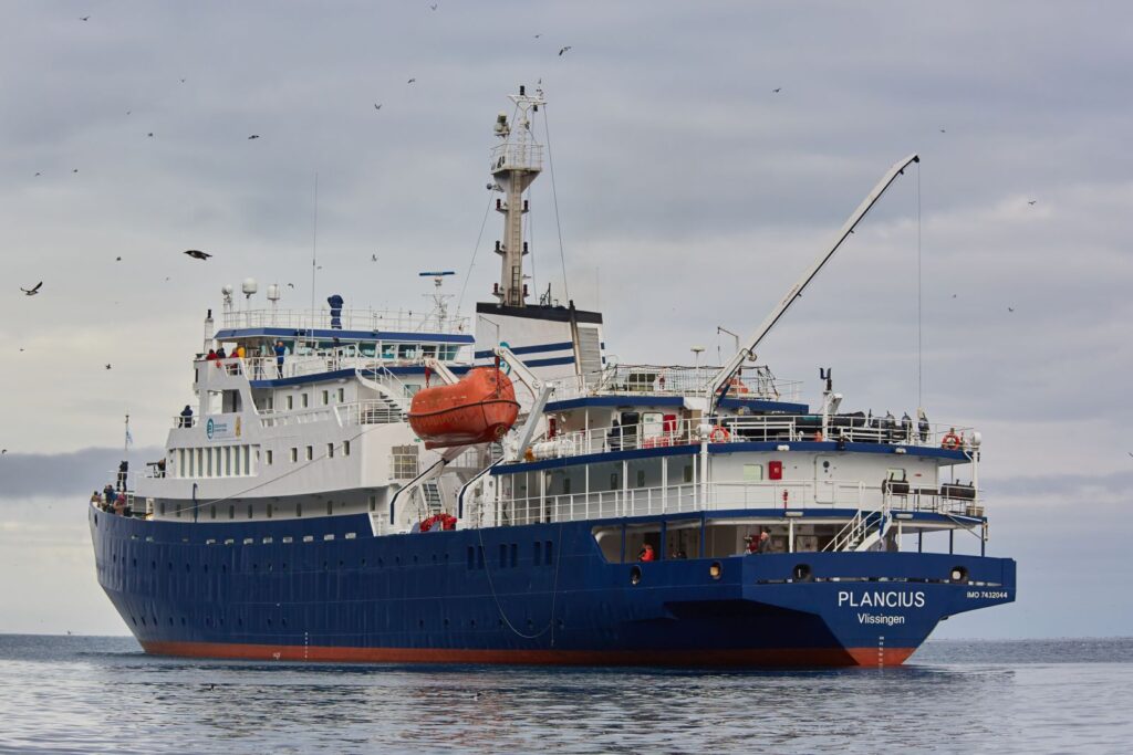
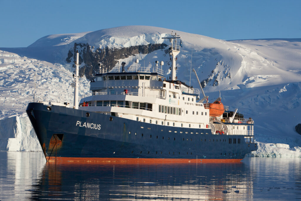
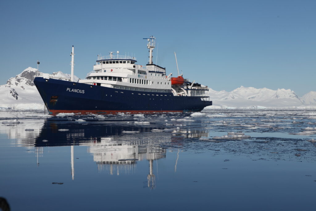
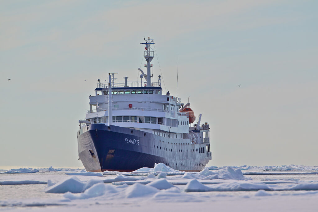
M/V Plancius (DIVING)
Plancius was built in 1976 as an oceanographic research vessel for the Royal Dutch Navy and was named Hr. Ms. Tydeman.
The ship sailed for the Dutch Navy until June 2004 when it was purchased by Oceanwide Expeditions. Plancius is a Dutch flagged completely rebuilt and converted passenger vessel complies with the latest SOLAS- regulations, classed by Lloyd’s Register in London. The name Plancius is a tribute to the predecessor of Oceanwide Expeditions (Plancius Foundation, 1981-1996), the first cruise operator on a yearly base in Spitsbergen, offering voyages with a small cruise vessel named Plancius.
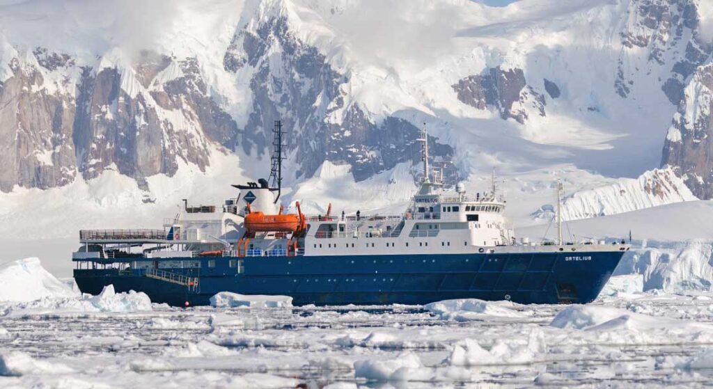
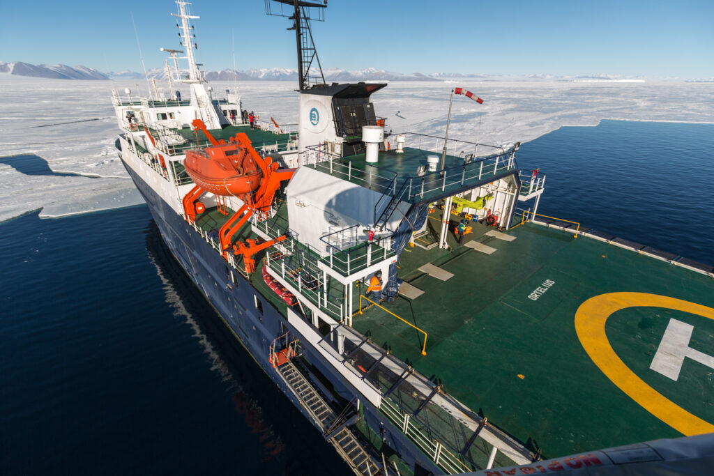
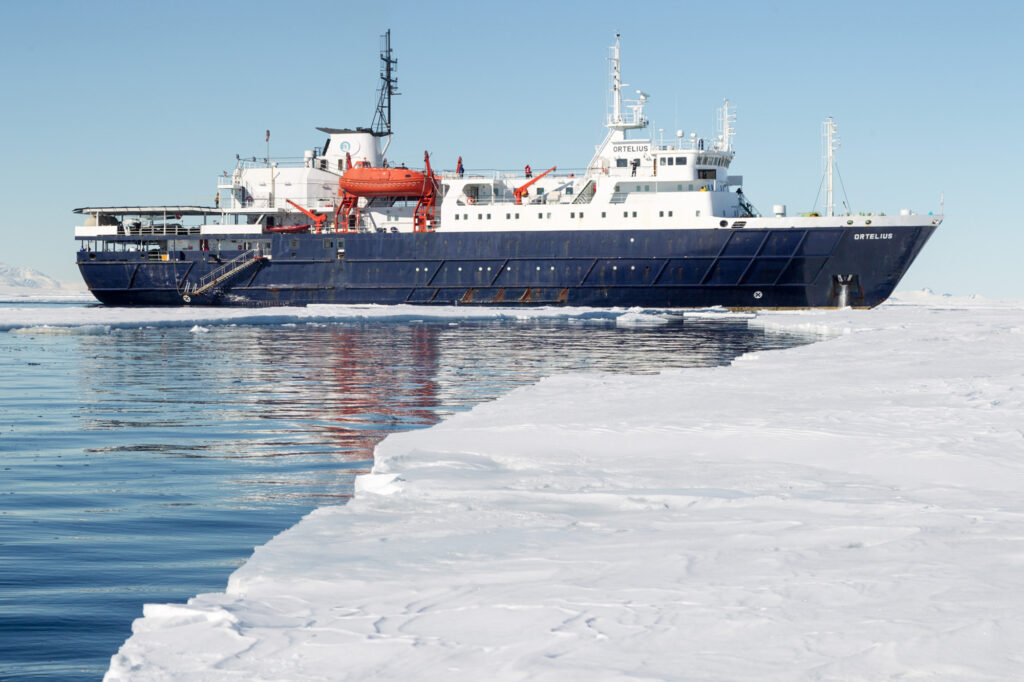
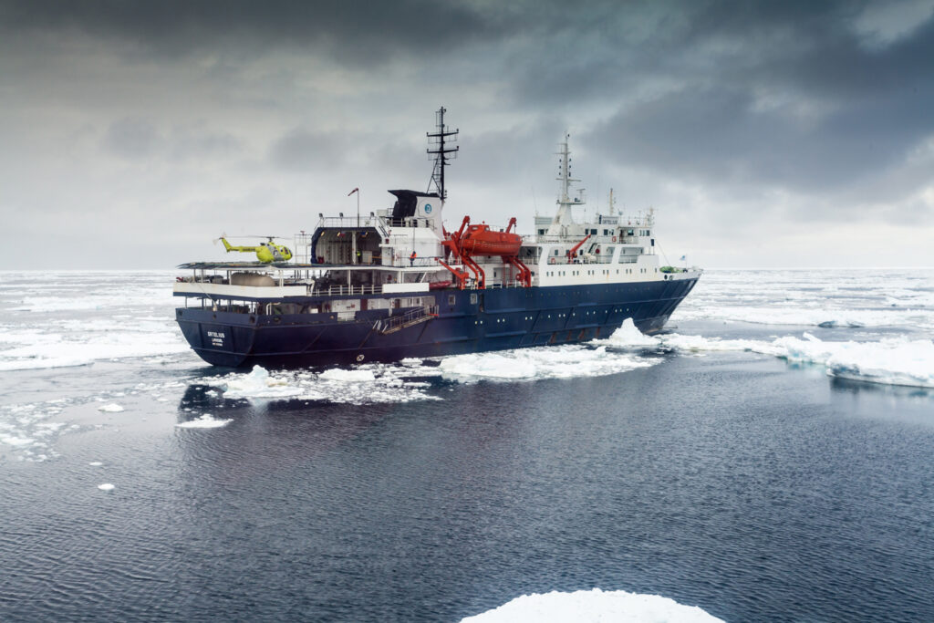
M/V Ortelius (DIVING)
The ice-strengthened vessel “Ortelius” is an excellent vessel for Polar expedition cruises in the Arctic and Antarctica, providing us with possibilities to adventure in remote locations such as the Ross Sea and Franz Josef Land. “Ortelius” was built in Gdynia, Poland in 1989, was named “Marina Svetaeva”, and served as a special purpose vessel for the Russian Academy of Science. The vessel is re-flagged and renamed “Ortelius”. As Plancius, Ortelius was a Dutch / Flemish cartographer. Abraham Ortelius (1527 – 1598) published the first modern world atlas, the Theatrum Orbis Terrarum or Theatre of the World in 1570. At that time, the atlas was the most expensive book ever printed.
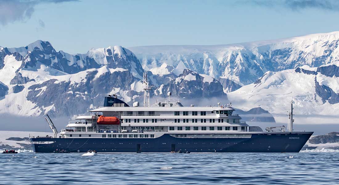
M/V Hondius (DIVING)
Hondius is the world’s first-registered Polar Class 6 passenger vessel, making her among the most structurally fortified and technologically advanced polar cruise ships on the seas. This vessel fully complies with the mandatory requirements of the Polar Code as adopted by the International Maritime Organization (IMO) for safe and environmentally sound ship operation in the polar regions.
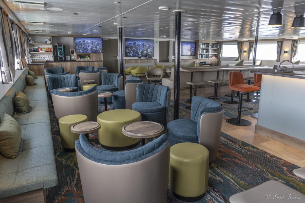
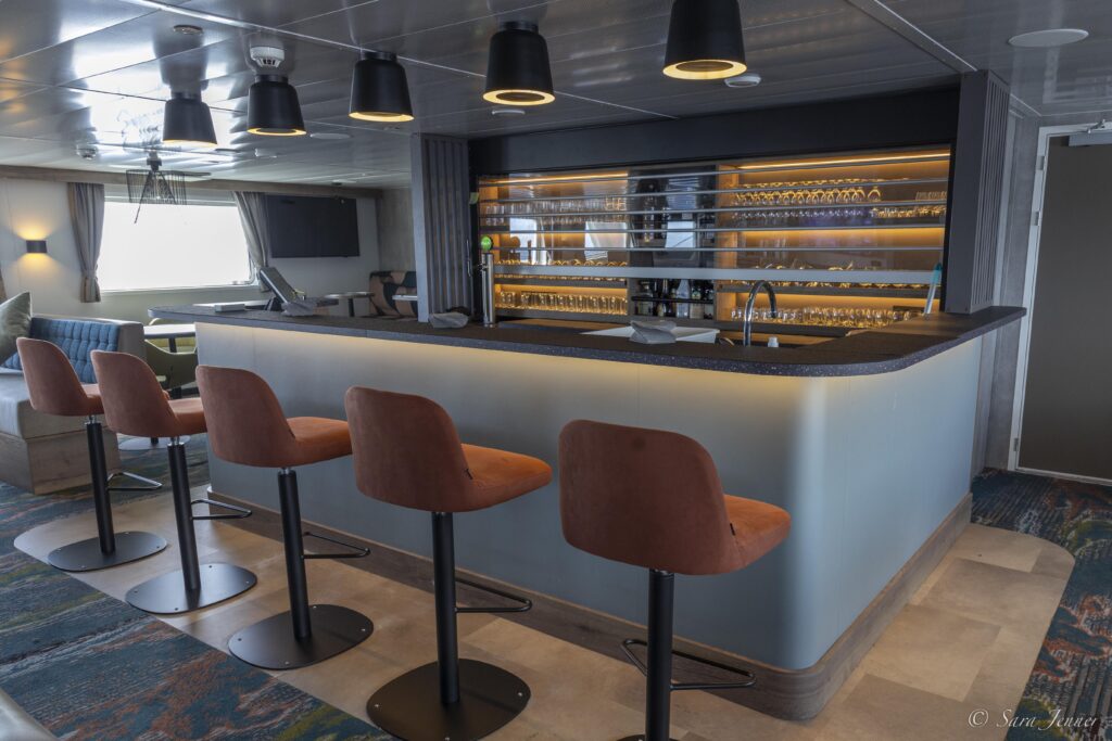
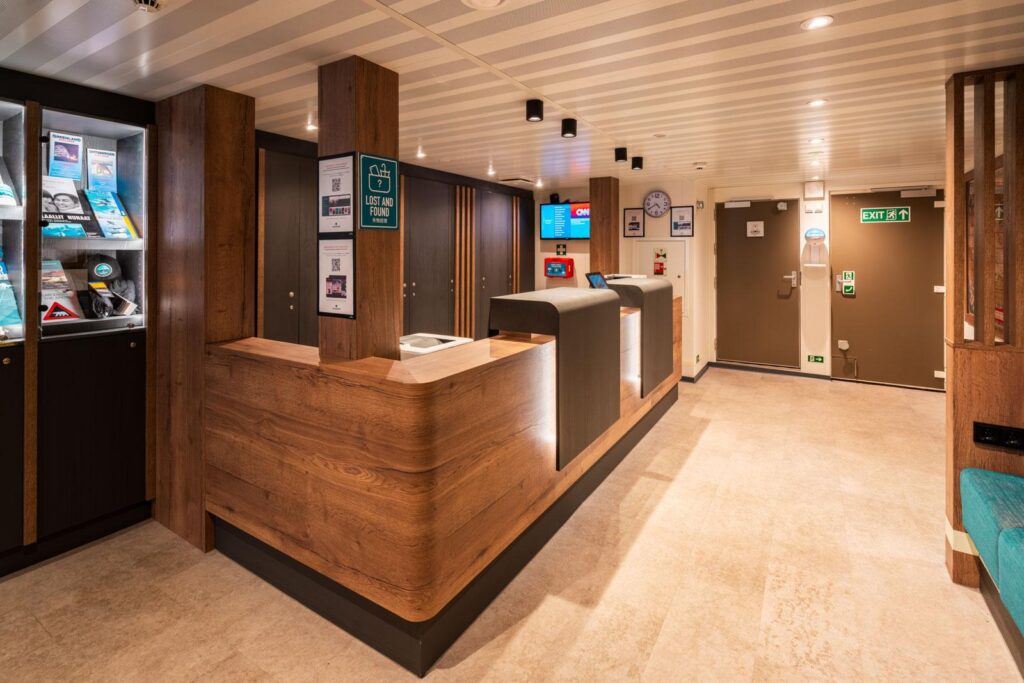
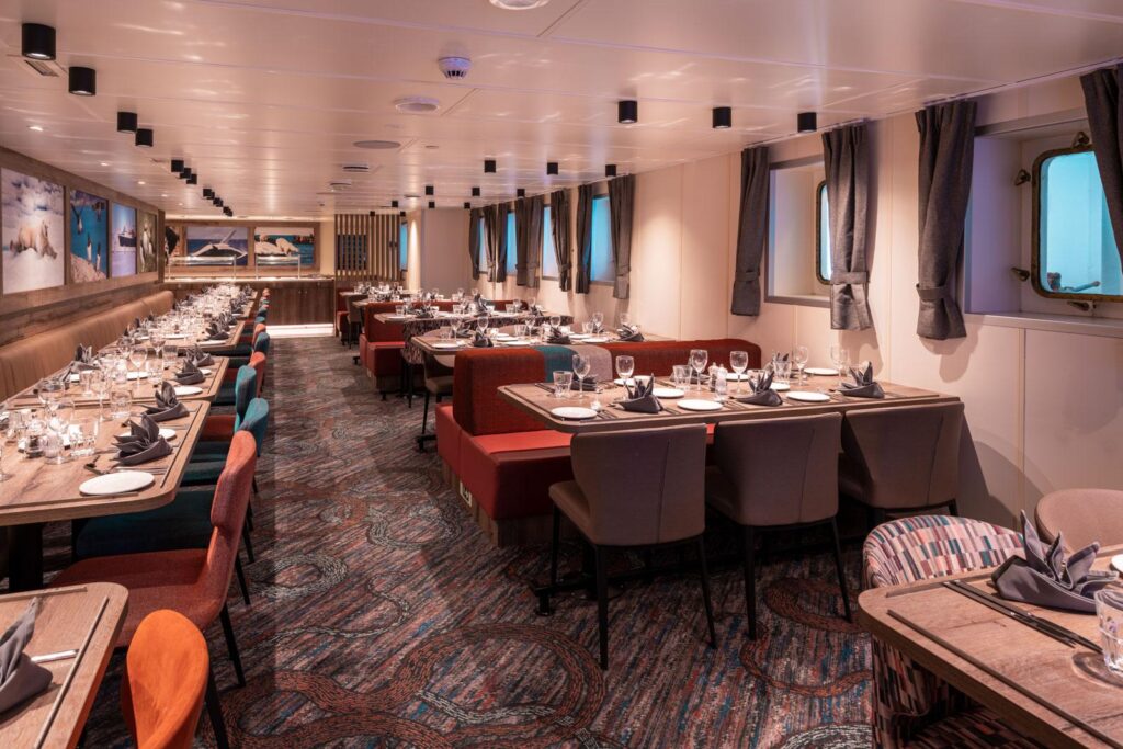
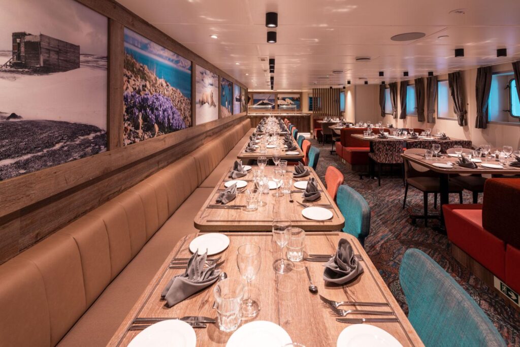
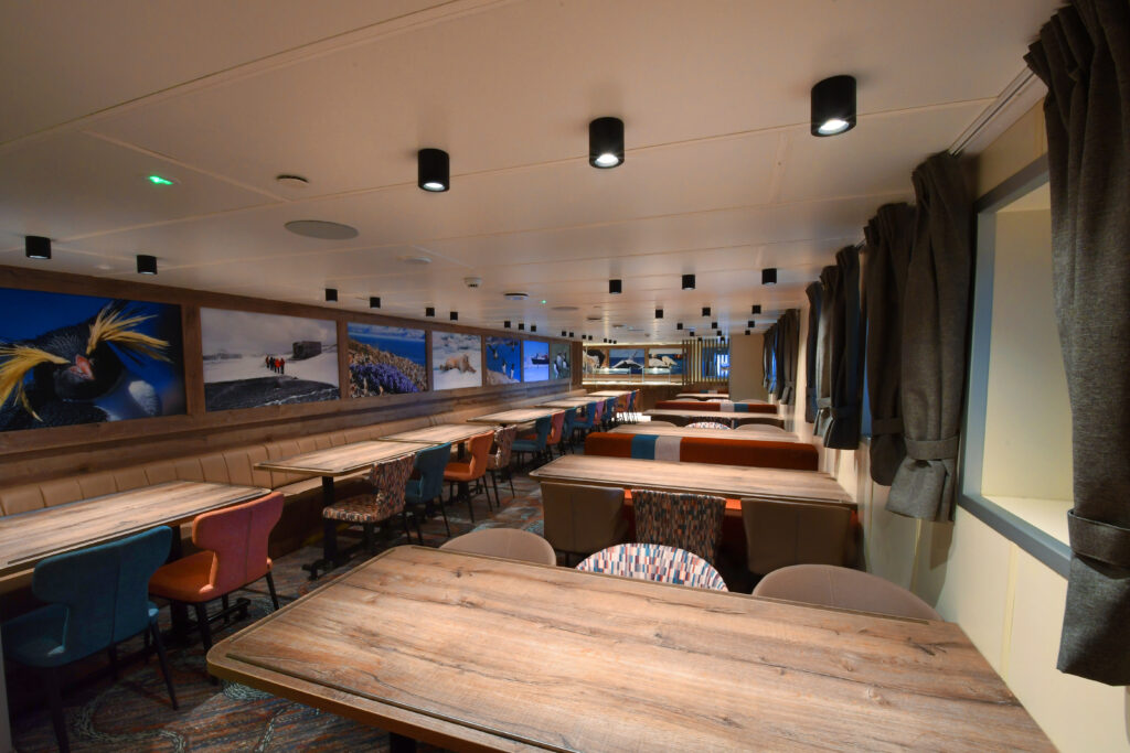
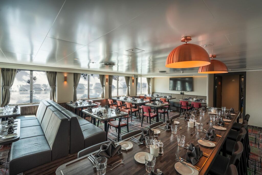
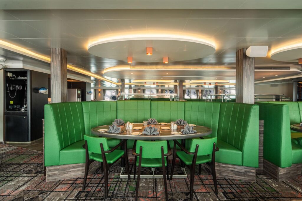
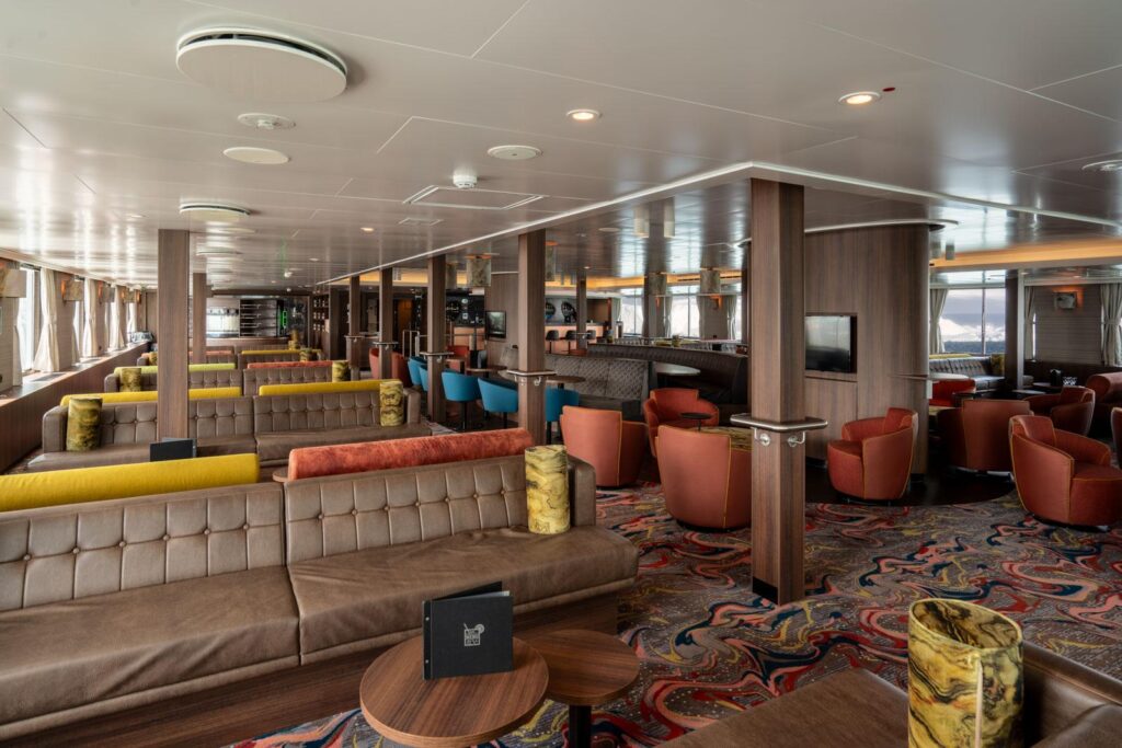
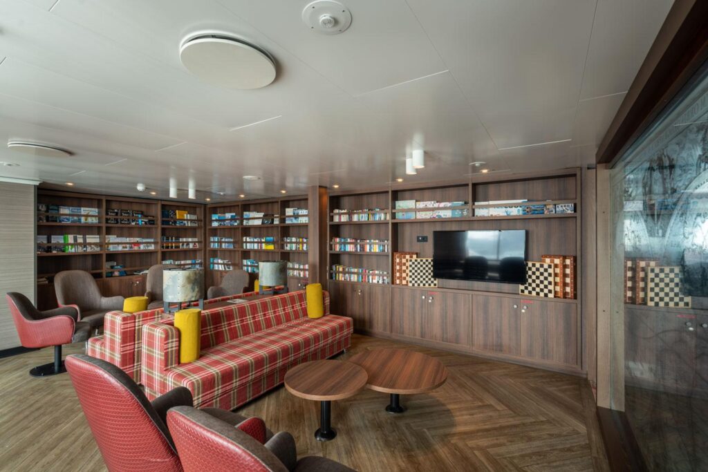
Features:
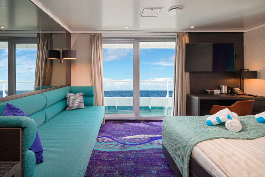
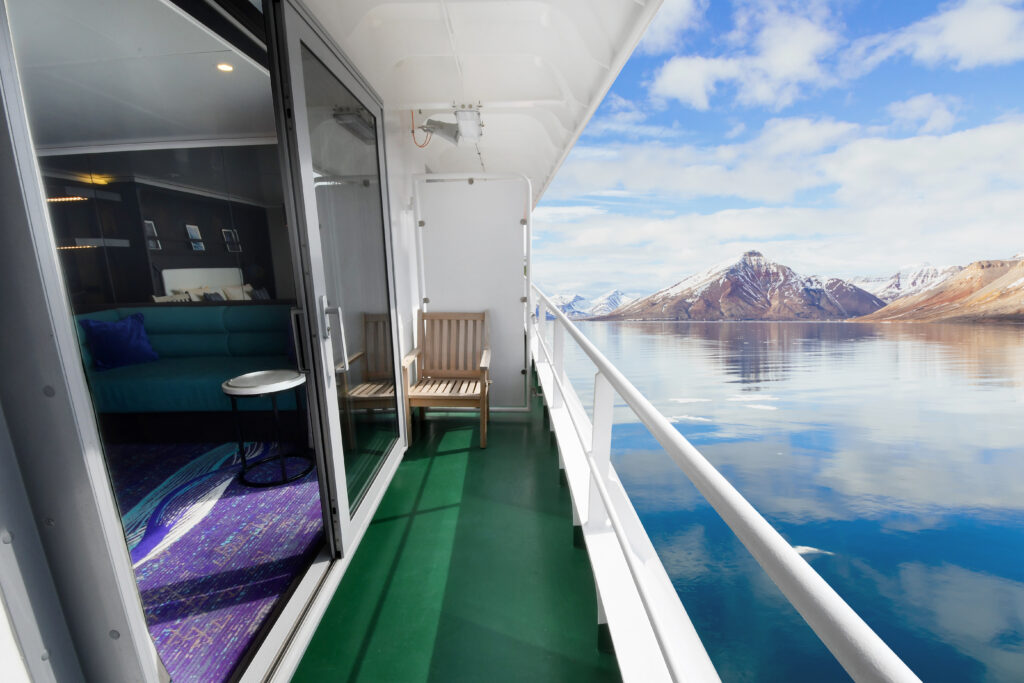
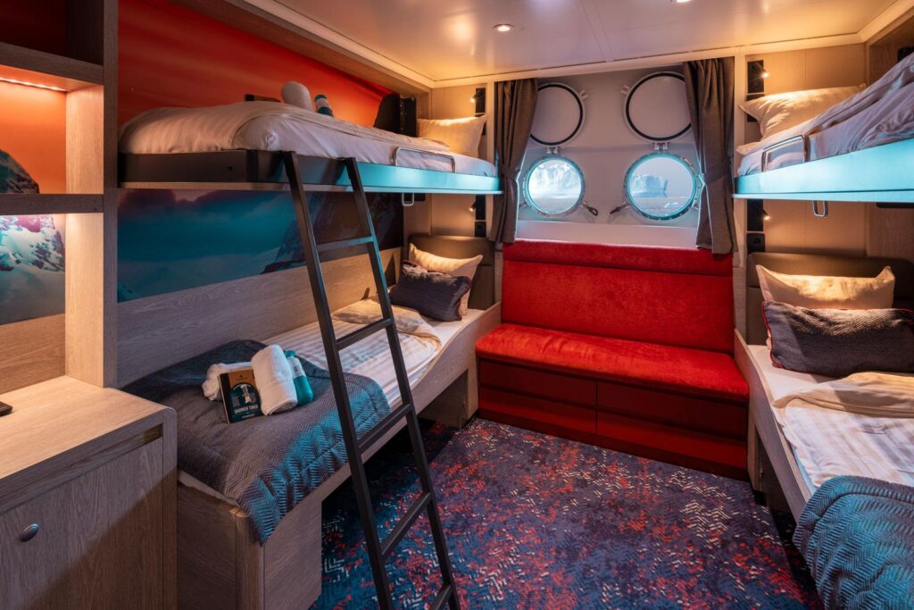
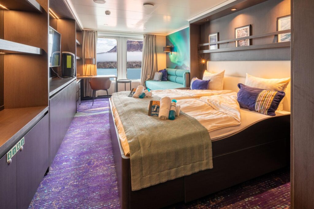
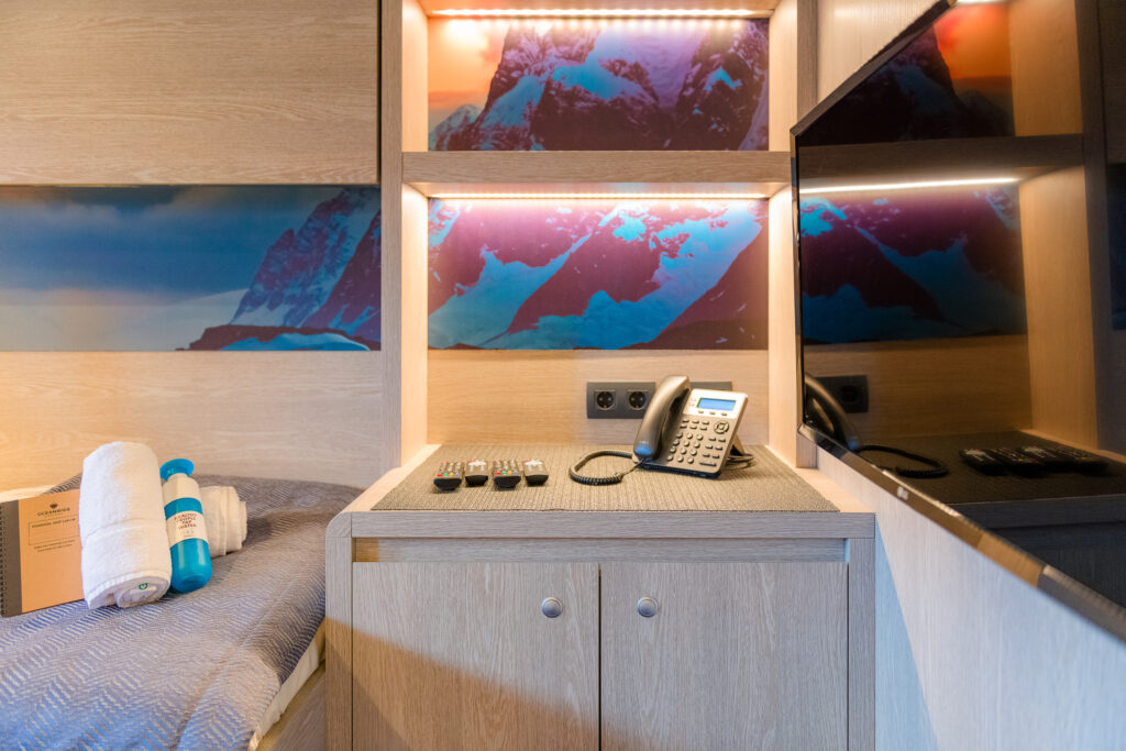
Cabins
50-80 CabinsDuration
7-28 NightsDifficulty
Intermediate - AdvancedTrip Inclusions/Exclusions
Please contact us at info@apexoceantravel.com
The included costs will vary based on the ship, destination, and itinerary
Please contact us at info@apexoceantravel.com
The excluded costs will vary based on the ship, destination, and itinerary
Join our newsletter and receive $100 credit
Falklands, South Georgia and Antarctica - Photographic Special
**Itineraries are subject to change** All itineraries are for guidance only. Programs may vary depending on ice, weather, and wildlife conditions. Landings are subject to site availabilities, permissions, and environmental concerns per IAATO regulations. Official sailing plans and landing slots are scheduled with IAATO prior to the start of the season, but the expedition leader determines the final plan. Flexibility is paramount for expedition cruises. The average cruising speed for our vessel is 10.5 knots
Sandy Argentine beaches
You embark from Puerto Madryn in the afternoon, your prow aimed for the Falkland Islands. Golfo Nuevo is renowned for its visiting southern right whales, so you have a good chance of spotting one as you sail toward the open ocean
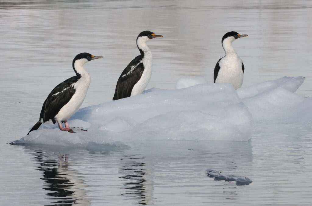
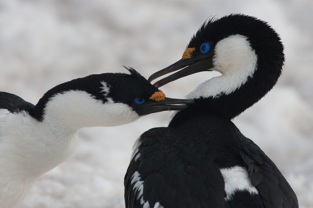
Sea life, sea birds
Though you’re now at sea, there’s rarely a lonesome moment here. Several species of bird follow the vessel southeast, such as albatrosses, storm petrels, shearwaters, and diving petrels.
Finding the Falklands
The Falkland Islands offer an abundance of wildlife that is easily approachable, though caution is always advised. These islands are largely unknown gems, the site of a 1982 war between the UK and Argentina. Not only do various species of bird live here, but chances are great you’ll see both Peale’s dolphins and Commerson’s dolphins in the surrounding waters. During this segment of the voyage, you may visit the following sites:
Steeple Jason – Home to the world’s largest black-browed albatross colony (roughly 113,000), Steeple Jason is a wild and rarely visited island buffeted by wind and waves. Weather and swell conditions dictate the journey here.
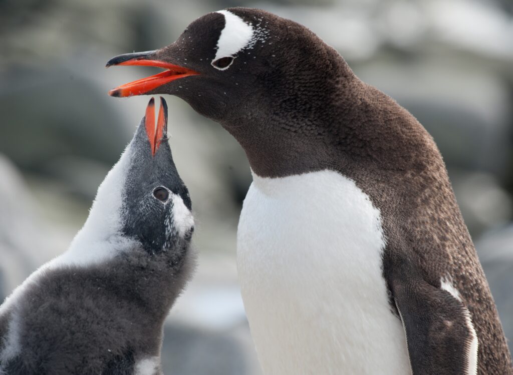
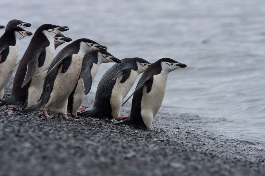
Carcass Island – Despite its name, this island is pleasantly rodent-free and hence bounteous with birdlife and many endemic species. Anything from breeding Magellanic penguins and gentoos to numerous waders and passerine birds (including Cobb’s wrens and tussock-birds) live here.
Saunders Island – On Saunders Island you can see the black-browed albatross and its sometimes-clumsy landings, along with breeding imperial shags and rockhopper penguins. King penguins, Magellanic penguins, and gentoos are also found here.
The seat of Falklands culture
The capital of the Falklands and center of its culture, Port Stanley has some Victorian-era charm: colorful houses, well-tended gardens, and Englishstyle pubs are all to be found here. You can also see several century-old clipper ships nearby, silent witnesses to the hardships of 19th century sailors. The small but interesting museum is also worth a visit, covering the early days of settlement up to the Falklands War. Approximately 2,100 people live in Port Stanley. Admission to the museum is included.
Once more to the sea
En route to South Georgia, you now cross the Antarctic Convergence. The temperature cools considerably within the space of a few hours, and nutritious water rises to the surface of the sea due to colliding water columns. This phenomenon attracts a multitude of seabirds near the ship, including several species of albatross, shearwaters, petrels, prions, and skuas.
South Georgia journey
Today you arrive at the first South Georgia activity site. Please keep in mind that weather conditions in this area can be challenging, largely dictating the program.
Sites you might visit include:
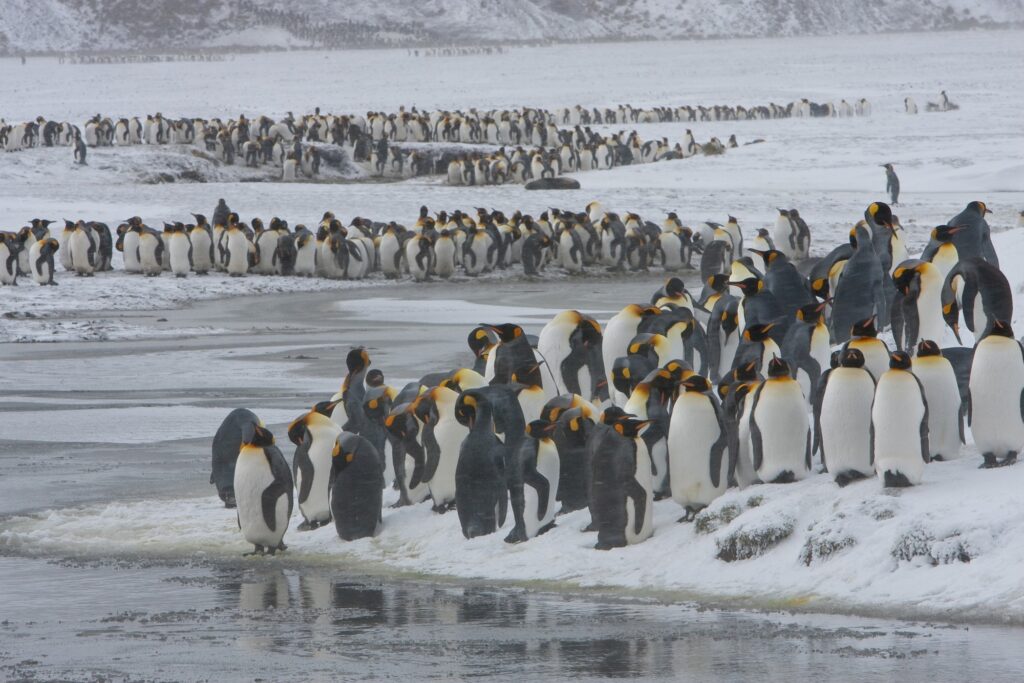
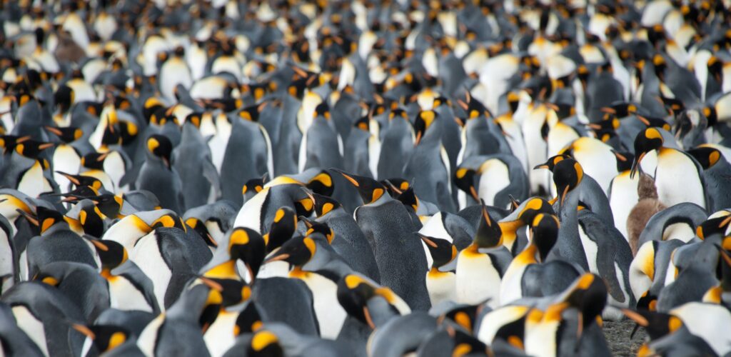
Salisbury Plain, St. Andrews Bay, Gold Harbour– These sites not only house the three largest king penguin colonies in South Georgia, they’re also three of the world’s largest breeding beaches for southern elephant seals. Only during this time of year do they peak in their breeding cycle. Watch the four-ton bulls keep a constant vigil (and occasionally fight) over territories where dozens of females have just given birth or are about to deliver. You can also see a substantial number of Antarctic fur seals here during the breeding season (December – January).
Fortuna Bay – A beautiful outwash plain from Fortuna Glacier is home to a large number of king penguins and seals. Here you may also have the chance to follow the final leg of Shackleton’s route to the abandoned whaling village of Stromness. This path cuts across the mountain pass beyond Shackleton’s Waterfall, and as the terrain is partly swampy, be prepared to cross a few small streams.
Grytviken – In this abandoned whaling station, king penguins walk the streets and elephant seals lie around like they own the place – because they basically do. Here you might be able to see the South Georgia Museum as well as Shackleton’s grave. In the afternoon of day 11 and depending on the conditions, we will start sailing southwards in the direction of the South Orkney Islands.
Southward bound
There may be sea ice on this route, and at the edge of the ice some south polar skuas and snow petrels could join the other seabirds trailing the vessel south.
The scenic vistas of South Orkne
Depending on the conditions, you might visit Orcadas Base, an Argentine scientific station on Laurie Island in the South Orkney archipelago. The personnel here will happily show you their facility, where you can enjoy expansive views of the surrounding glaciers. If a visit isn’t possible, you may instead land at Signy Island’s Shingle Cove.
Entering the Antarctic
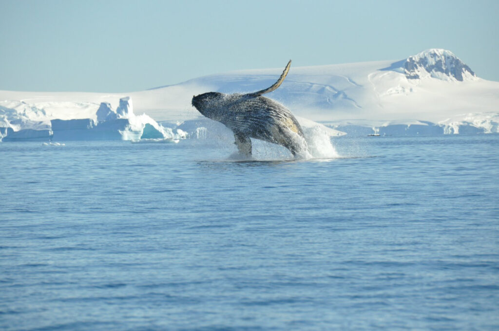
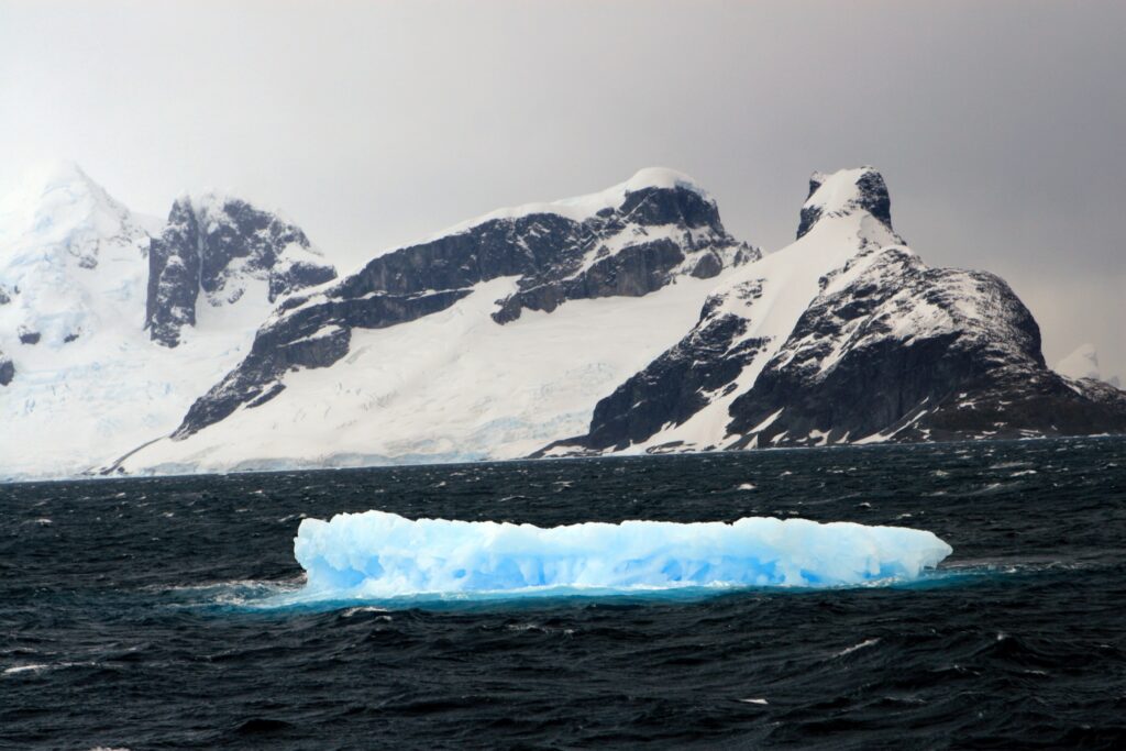
Enormous icebergs and a fair chance of fin whale sightings ensure there’s never a dull moment on this last sea voyage south. Also, your best chance to spot Antarctic petrels is here. Depending on conditions, we aim to begin activities the afternoon of day 15.
Awe-inspiring Antarctica
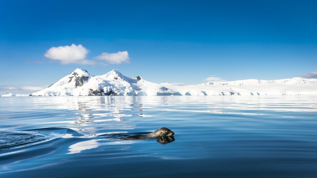
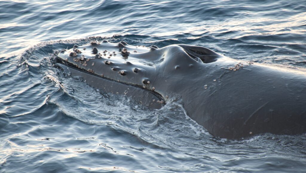
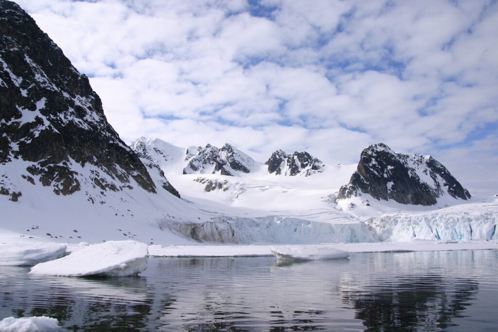
If the ice conditions permit, you now sail into the Weddell Sea. Here colossal tabular icebergs herald your arrival to the eastern side of the Antarctic Peninsula. Paulet Island, with its large population of Adélie penguins, is a possible stop. You might also visit Brown Bluff, located in the ice-clogged Antarctic Sound, where you could get the chance to set foot on the Antarctic Continent itself. If conditions aren’t favorable to enter the Weddell Sea from the east, the ship will set course for Elephant Island and head into the Bransfield Strait, between the South Shetland Island's and the Antarctic Peninsula. The volcanic islands of the South Shetlandsare windswept and often cloaked in mist, but they nonetheless offer many subtle pleasures. A wide variety of flora (mosses, lichens, flowering grasses) and fauna (gentoo penguins, chinstrap penguins, southern giant petrels) live here. On Half Moon Island, Chinstrap penguins and Weddell seals often haul out onto the beach near Cámara Base, an Argentine scientific research station. On Deception Island, the ship plunges through Neptune’s Bellows and into the flooded caldera. Here you can find an abandoned whaling station, and thousands of cape petrels. A number of kelp gulls, brown skuas, south polar skuas, and Antarctic terns can be spotted too. Wilson’s storm petrels and black-bellied storm petrels also nest in the ruins of the whaling station in Whalers Bay. As an alternative, you can take part in activities near Telefon Bay, further inside the caldera. This extended voyage gives you the chance to sail even farther down the icy coast of the western Antarctic Peninsula. There are several opportunities for great landings where you might set foot on the Antarctic Continent, surrounded by an epic landscape of alpine peaks and mammoth glaciers calving at sea level. Gentoo penguins, leopard seals, Weddell seals, humpback whales, and minke whales are often seen here. The breathtaking scenery continues in the Bransfield Straight and, if conditions allow further South in the Gerlache Strait. Conditions on the Drake Passage determine the exact time of departure.
Familiar seas, familiar friends
Your return voyage is far from lonely. While crossing the Drake, you’re again greeted by the vast array of seabirds remembered from the passage south. But they seem a little more familiar to you now, and you to them.
Earth’s southernmost city
You arrive and disembark in Ushuaia, commonly held to be the world’s most southern city. It is located on the Tierra del Fuego archipelago, nicknamed the “End of the World.” But despite this stopping point, the wealth of memories you’ve made on your Antarctic expedition will travel with you wherever your next adventure lies.
Antarctica - Discovery and learning voyage
**Itineraries are subject to change** All itineraries are for guidance only. Programs may vary depending on ice, weather, and wildlife conditions. Landings are subject to site availabilities, permissions, and environmental concerns per IAATO regulations. Official sailing plans and landing slots are scheduled with IAATO prior to the start of the season, but the expedition leader determines the final plan. Flexibility is paramount for expedition cruises. The average cruising speed for our vessel is 10.5 knots
End of the world, start of a journey
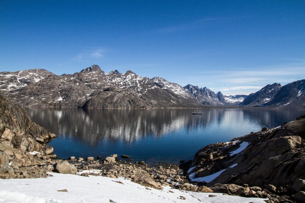
Your voyage begins where the world drops off. Ushuaia, Argentina, reputed to be the southernmost city on the planet, is located on the far southern tip of South America. Starting in the afternoon, you embark from this small resort town on Tierra del Fuego, nicknamed “The End of the World,” and sail the mountain-fringed Beagle Channel for the remainder of the evening.
Path of the polar explorers
Over the next two days on the Drake Passage, you enjoy some of the same experiences encountered by the great polar explorers who first charted these regions: cool salt breezes, rolling seas, maybe even a fin whale spouting up sea spray. After passing the Antarctic Convergence – Antarctica’s natural boundary, formed when north-flowing cold waters collide with warmer sub-Antarctic seas – you are in the circum Antarctic upwelling zone. Not only does the marine life change, the avian life changes too. Wandering albatrosses, grey-headed albatrosses, black-browed albatrosses, light-mantled sooty albatrosses, cape pigeons, southern fulmars, Wilson’s storm petrels, blue petrels, and Antarctic petrels are a few of the birds you might see.
Enter the Antarctic
Gray stone peaks sketched with snow, towers of broken blue-white ice, and dramatically different wildlife below and above. You first pass the snow-capped Melchior Islands and Schollaert Channel, sailing between Brabant and Anvers Islands. Sites you may visit include:
Danco Island – Activities here may focus on the gentoo penguins nesting on the island, in addition to the Weddell and crabeater seals that can be found nearby. Neko Harbour – An epic landscape of mammoth glaciers and endless wind-carved snow, Neko Harbour offers opportunities for a Zodiac cruise and landing that afford the closest views of the surrounding alpine peaks.
Paradise Bay– You may be able to take a Zodiac cruise in these sprawling, ice-flecked waters, where there’s a good chance you’ll encounter humpback and minke whales.
Port Lockroy – After sailing through the Neumayer Channel, you may get a chance to visit the former British research station – now a museum and post office – of Port Lockroy on Goudier Island. You may also be able to partake in activities around Jougla Point, meeting gentoo penguins and blue-eyed shags.
Scenes of South Shetland
The volcanic islands of the South Shetlands are windswept and often cloaked in mist, but they do offer subtle pleasures: There’s a wide variety of flora (mosses, lichens, flowering grasses) and no small amount of fauna (gentoo penguins, chinstrap penguins, southern giant petrels). In Deception Island, the ship plunges through Neptune’s Bellows and into the flooded caldera. Here you find an abandoned whaling station, and thousands of cape petrels – along with kelp gulls, brown and south polar skuas, and Antarctic terns. A good hike is a possibility in this fascinating and desolate volcanic landscape. As an alternative, you may be able to engage in activities near Half Moon Island. Here chinstrap penguins and Weddell seals often haul out onto the beach near Cámara Base, an Argentine scientific research station. Conditions on the Drake Passage determine the exact time of departure.
Familiar seas, familiar friends
Your return voyage is far from lonely. While crossing the Drake, you’re again greeted by the vast array of seabirds remembered from the passage south. But they seem a little more familiar to you now, and you to them.
There and back again
Every adventure, no matter how grand, must eventually come to an end. It’s now time to disembark in Ushuaia, but with memories that will accompany you wherever your next adventure lies.
Antarctica - Basecamp - free camping, kayaking, snowshoe/hiking, mountaineering, photo workshop
**Itineraries are subject to change** All itineraries are for guidance only. Programs may vary depending on ice, weather, and wildlife conditions. Landings are subject to site availabilities, permissions, and environmental concerns per IAATO regulations. Official sailing plans and landing slots are scheduled with IAATO prior to the start of the season, but the expedition leader determines the final plan. Flexibility is paramount for expedition cruises. The average cruising speed for our vessel is 10.5 knots
End of the world, start of a journey
Your voyage begins where the world drops off. Ushuaia, Argentina, reputed to be the southernmost city on the planet, is located on the far southern tip of South America. Starting in the afternoon, you embark from this small resort town on Tierra del Fuego, nicknamed “The End of the World,” and sail the mountain-fringed Beagle Channel for the remainder of the evening.
Path of the polar explorers
Over the next two days on the Drake Passage, you enjoy some of the same experiences encountered by the great polar explorers who first charted these regions: cool salt breezes, rolling seas, maybe even a fin whale spouting up sea spray. After passing the Antarctic Convergence – Antarctica’s natural boundary, formed when north-flowing cold waters collide with warmer sub-Antarctic seas – you are in the circum Antarctic upwelling zone. Not only does the marine life change, the avian life changes too. Wandering albatrosses, grey-headed albatrosses, black-browed albatrosses, light-mantled sooty albatrosses, cape pigeons, southern fulmars, Wilson’s storm petrels, blue petrels, and Antarctic petrels are a few of the birds you might see.
Enter the Antarctic
Gray stone peaks sketched with snow, towers of broken blue-white ice, and dramatically different wildlife below and above. You first pass the snow-capped Melchior Islands and Schollaert Channel, sailing between Brabant and Anvers Islands. Places you might visit includes:
Neumayer Channel – The vessel may position itself here, launching its multiple basecamp activities from the protected waters around Wiencke Island. You can enjoy the splendors of this alpine environment at sea with Zodiac and kayaking trips, or if you’re in the mood for a walk, there are possible snowshoe hikes and soft-climb mountaineering options farther inland. Naturally, favorable weather conditions determine the possible activities.
Port Lockroy – After sailing through the Neumayer Channel, you may get a chance to visit the former British research station – now a museum and post office – of Port Lockroy on Goudier Island. You may also be able to partake in activities around Jougla Point, meeting gentoo penguins and blue-eyed shags. At the nearby sites, such as Damoy Point there may be the opportunity for snowshoeing to the old ski-way, this is also one of our favourite camping sites.
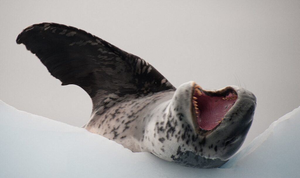
Pléneau & Petermann Islands– If the ice allows it, you can sail through the Lemaire Channel in search of Adélie penguins and blue-eyed shags. There’s also a good chance you’ll encounter humpback and minke whales here, as well as leopard seals. Kayaking, glacier walks, and more ambitious mountaineering trips are the potential activities of this location.
Neko Harbour – An epic landscape of mammoth glaciers and endless wind-carved snow, Neko Harbour offers opportunities for a Zodiac cruise and landing that afford the closest views of the surrounding alpine peaks.
Paradise Bay – You have the chance to make camp here like a true polar explorer, enjoying a supreme overnight Antarctic adventure.
Errera Channel – Possible sites in this area include Danco Island and Cuverville Island, but also the lesser known (though equally picturesque) Orne Island and Georges Point on Rongé Island. On your last day of near-shore activities, you pass the Melchior Islands toward the open sea. Keep a sharp lookout for humpback whales in Dallmann Bay. You might also shoot for Half Moon Island, in the South Shetlands, with further chances for activities. Conditions on the Drake Passage determine the exact time of departure
Familiar seas, familiar friends
Your return voyage is far from lonely. While crossing the Drake, you’re again greeted by the vast array of seabirds remembered from the passage south. But they seem a little more familiar to you now, and you to them.
There and back again
Every adventure, no matter how grand, must eventually come to an end. It’s now time to disembark in Ushuaia, but with memories that will accompany you wherever your next adventure lies.
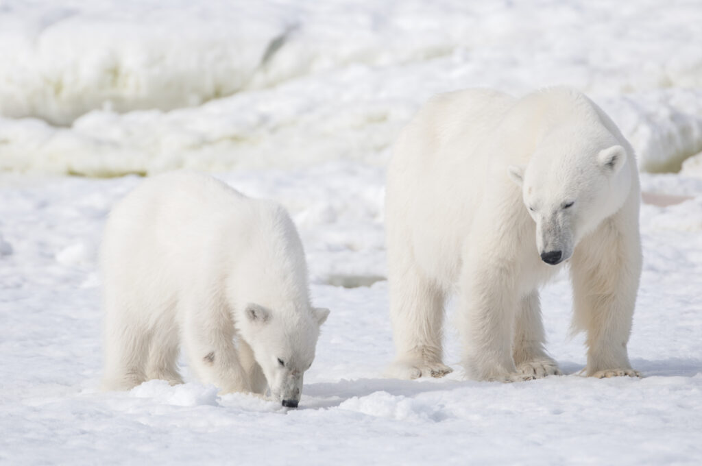
Around Spitsbergen, In the realm of Polar Bear & Ice
**Itineraries are subject to change** All itineraries are for guidance only. Programs may vary depending on ice, weather, and wildlife conditions. Landings are subject to site availabilities, permissions, and environmental concerns per IAATO regulations. Official sailing plans and landing slots are scheduled with IAATO prior to the start of the season, but the expedition leader determines the final plan. Flexibility is paramount for expedition cruises. The average cruising speed for our vessel is 10.5 knots
Largest town, biggest island
You touch down in Longyearbyen, the administrative center of Spitsbergen, the largest island of the Svalbard archipelago. Enjoy strolling around this former mining town, whose parish church and Svalbard Museum make for fascinating attractions. Though the countryside appears stark, more than a hundred species of plant have been recorded in it. In the early evening the ship sails out of Isfjorden, where you might spot the first minke whale of your voyage.
Clockwise circumnavigation of West Spitsbergen
Krossfjorden and Ny Ålesund
Heading north along the west coast, you may arrive by morning in Krossfjorden with great views on glacier fronts. In the afternoon you sail to Ny Ålesund, the northernmost settlement on Earth. Once a mining village served by the world’s most northerly railway – you can still see its tracks – Ny Ålesund is now a research center. Close to the community is a breeding ground for barnacle geese, pink-footed geese, and Arctic terns. And if you’re interested in the history of Arctic exploration, visit the anchoring mast used by polar explorers Amundsen and Nobile in their airships, Norge (1926) and Italia (1928).
The massive Monaco Glacier
Depending on the weather, you could sail into Liefdefjorden, land at Texas Bar, and cruise within sight of the 5-kilometer-long (3.1 miles) face of the precipitous Monaco Glacier. The waters in front of this glacier are a favorite feeding spot for thousands of kittiwakes, and the base of the ice is a popular polar bear hunting ground. Another possibility is the mouth of Wijdefjorden with at both sides tundra landscape and a the glacier front of Nordbreen. If ice conditions prevent sailing here early in the season, an alternate route along the west coast of Spitsbergen can be implemented.
Stop at the Seven Islands
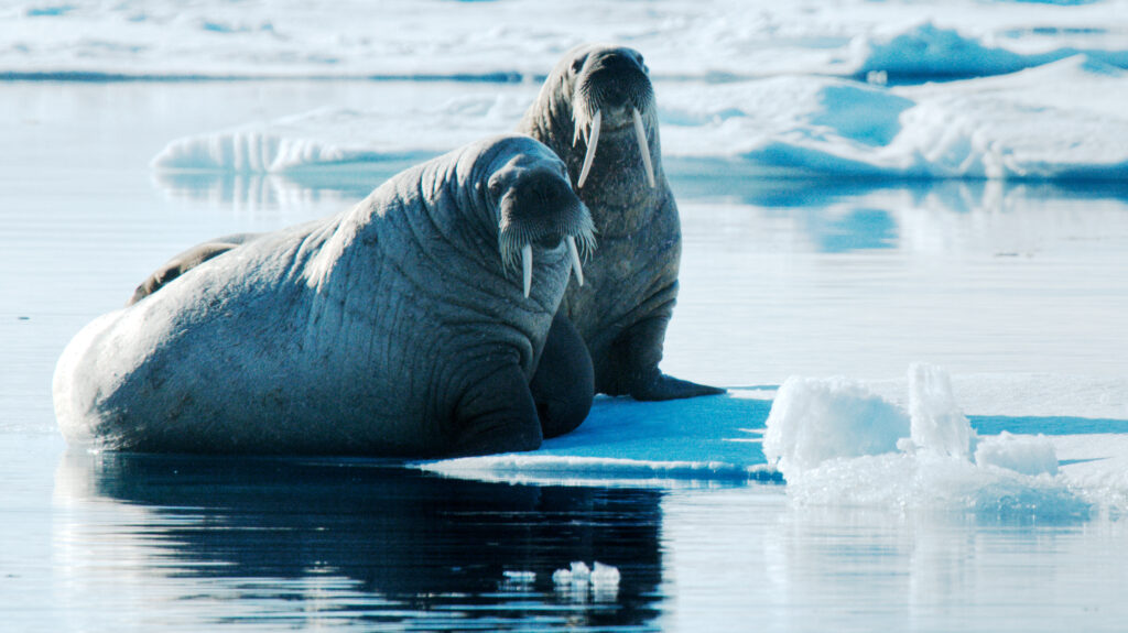
The northernmost point of your voyage may be north of Nordaustlandet, at Chermsideøya, and Phippsøya in the Seven Islands. Here you reach 80° north, just 870 km (540 miles) from the geographic North Pole. Polar bears inhabit this region, so the ship may park for several hours among the pack ice before wheeling around west again. When the edge of this sea ice is tens of miles north of the Seven Islands (mostly in August), you can spend a second day in this area. Alternatively (mostly in July) you may turn to Sorgfjord, where you have the chance to find a herd of walruses not far from the graves of 17th-century whalers at Eolusneset. A nature walk here can bring you close to families of ptarmigans. The opposite side of the fjord at Heclahamna is also a beautiful area for an excursion.
Highlights of Hinlopen
Today you sail into Hinlopen Strait, home to bearded and ringed seals as well as polar bears. At the entrance there is even the possibility to spot blue whales. As with Liefdefjorden, you can take an alternate west Spitsbergen route if ice prevents entry into Hinlopen. After cruising among the ice floes of Lomfjord in the Zodiacs, you then view the bird cliffs of Alkefjellet with their thousands of Brünnich’s guillemots. On the east side of Hinlopen Strait, you may attempt a landing in Palanderbukta where reindeer, pink-footed geese, and walruses are likely sights. Alternatively, at Torrelneset you can also visit the polar desert of Nordaustlandet, next to the world’s third-largest ice cap. Here you may encounter walruses during a coastline hike over the area’s raised beaches.
Storfjorden's many bounties
The plan is to sail through Freemansundet, the strait between Barentsøya and Edgeøya, with a stop on Barentsøya at Sundneset with the small Würzburgerhytta and lakes with waterfowl. Later in the day we may land at the mouth of the valley Skjolddalen on West Spitsbergen four kilometers from an Ivory Gull colony. A landing at Diskobukta on Edgeøya, near a canyon with a large Kittiwake colony is also an option. Other landings like at Kvalhovden near mighty glacier fronts are also possible.
Land of the Pointed Mountains
You start the day by cruising the side fjords of the Hornsund area of southern Spitsbergen, taking in the spire-like peaks: Hornsundtind rises 1,431 meters (4,695 feet), and Bautaen is a perfect illustration of why early Dutch explorers named this island Spitsbergen, meaning “pointed mountains.” There are 14 sizable glaciers in this area as well as opportunities for spotting seals, beluga whales, and polar bears. We may land in Samarinvaagen and Birgerbukta, where we have great opportunities for a long walk.
Bell Sund's flora, fauna, and haunting history
Today you find yourself in Bell Sund, one of the largest fjord systems in Svalbard. The ocean currents make this area slightly warmer than other areas in the archipelago, which shows in the relatively lush vegetation. Here there are excellent opportunities to enjoy both history and wildlife. A possibility is Ahlstrandhalvøya, at the mouth of Van Keulenfjorden, where piles of beluga skeletons can be found. These remains of 19th-century whale slaughter are a haunting reminder of the consequences of rampant exploitation. Fortunately, belugas were not hunted into extinction, and you have a good chance of coming across a pod. Alternately, while cruising the side fjords of Bellsund, you can explore tundra where reindeer like to feed as well as rock slopes where little auks are breeding, near Vaarsolbukta.
There and back again
Every adventure, no matter how grand, must eventually come to an end. You disembark in Longyearbyen, taking home memories that will accompany you wherever your next adventure lies.
North Spitsbergen Explorer - Versatile landscapes, sea ice & wildlife
**Itineraries are subject to change** All itineraries are for guidance only. Programs may vary depending on ice, weather, and wildlife conditions. Landings are subject to site availabilities, permissions, and environmental concerns per IAATO regulations. Official sailing plans and landing slots are scheduled with IAATO prior to the start of the season, but the expedition leader determines the final plan. Flexibility is paramount for expedition cruises. The average cruising speed for our vessel is 10.5 knots
Largest town, biggest island
You touch down in Longyearbyen, the administrative center of Spitsbergen, the largest island of the Svalbard archipelago. Enjoy strolling around this former mining town, whose parish church and Svalbard Museum make for fascinating attractions. Though the countryside appears stark, more than a hundred species of plant have been recorded in it. In the early evening the ship sails out of Isfjorden, where you might spot the first minke whale of your voyage.
North Spitsbergen’s natural beauty, wildlife, and pack-ice
This voyage will take you into the pack ice and along the remote shorelines of rugged north Spitsbergen. Places we might visit include the following:
Raudfjord
On the north coast of Spitsbergen, you can enjoy this expansive fjord spilling with glaciers – and maybe even visited by ringed and bearded seals. The cliffs and shoreline also support thriving seabird colonies, rich vegetation, and the possibility of polar bears. We will try to land at Alicehamna or Buchananhalvøya.
Monaco Glacier
Depending on the weather and sea ice, we could sail into Liefdefjorden, land at Texas Bar and cruise within sight of the 5-kilometer-long (3.1 miles) face of Monaco Glacier. The waters in front of this precipitous glacier are a favorite feeding spot for thousands of kittiwakes, and the base of the ice is a popular polar bear hunting ground. If ice conditions prevent us from sailing here early in the season, we may sail along the west coast of Spitsbergen.
Highlights of Hinlopen
We aim to sail into Hinlopen Strait, home to bearded seals, ringed seals, and polar bears. At the entrance, there is even the possibility to spot blue whales. After cruising among the ice floes of Lomfjord in the Zodiacs, you can view the bird cliffs of Alkefjellet, with their thousands of Brünnich’s guillemots. On the east side of Hinlopen Strait, we may attempt a landing on Nordaustlandet. Here we may see reindeer, pink-footed geese, and walruses. We can take an alternate route if ice prevents entry into Hinlopen.
The Seven Islands
The northernmost point of the voyage may be north of Nordaustlandet at Chermsideøya or Phippsøya, in the Seven Islands. Here we may reach 80° north, just 870 km (540 miles) from the geographic North Pole. Polar bears inhabit this region, so the ship may park for several hours among the pack ice before wheeling around west again.
Sailing the continental shelf
While retracing our route west, keep watch for polar bears and elusive Greenland (bowhead) whales. About 40 nautical miles west of Spitsbergen, we sail the edge of the continental shelf. Here fin whales forage during the summer in the upwelling zones (where cold, nutrient-rich water wells up from below the sea’s surface) that run along the Spitsbergen banks. At the mouth of Kongsfjorden, you have a good chance of sighting minke whales.
Forlandsundet, St. Johns Fjord, or Alkhornet
Walruses sometimes haul out in Forlandsundet at Sarstangen or Poolepynten. Alternatively, we might sail into St. Johns Fjord or south to the mouth of Isfjorden, landing at Alkhornet. Seabirds nest on these cliffs, Arctic foxes search below for fallen eggs and chicks, and reindeer graze the sparse vegetation.
There and back again
Every adventure, no matter how grand, must eventually come to an end. You disembark in Longyearbyen, taking home memories that will accompany you wherever your next adventure lies.
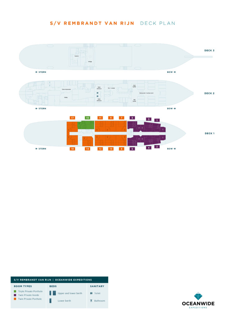
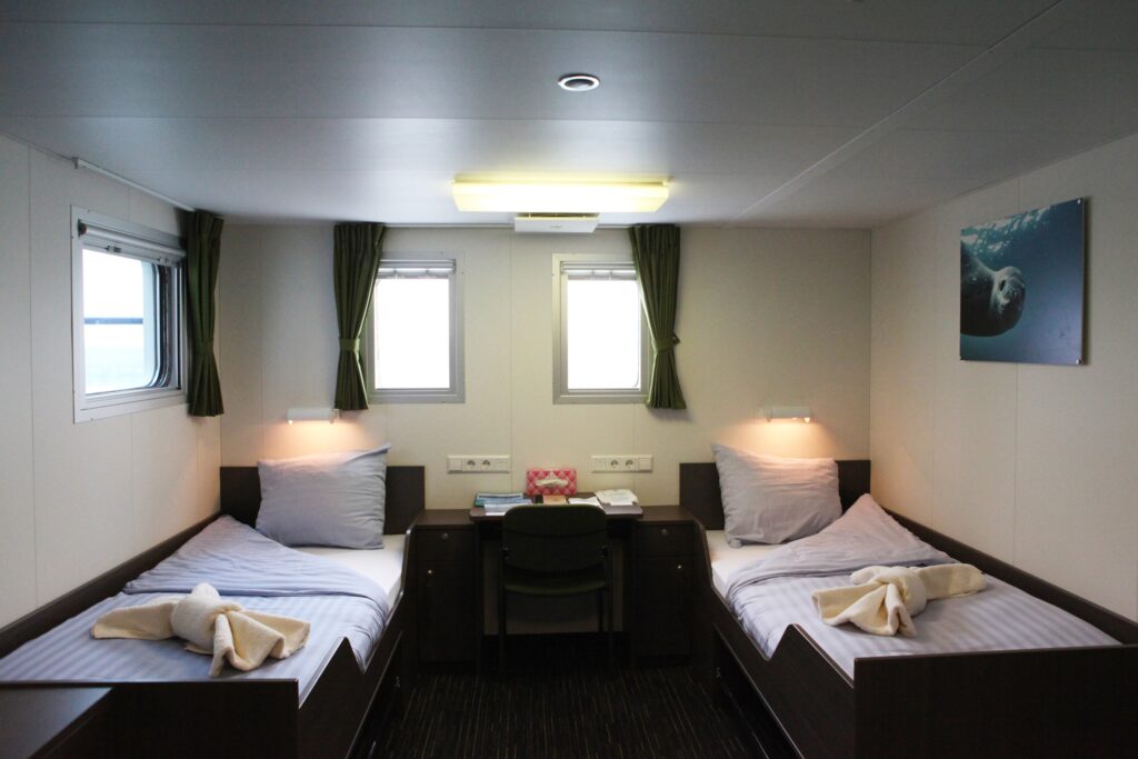
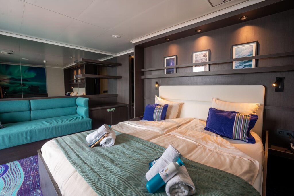
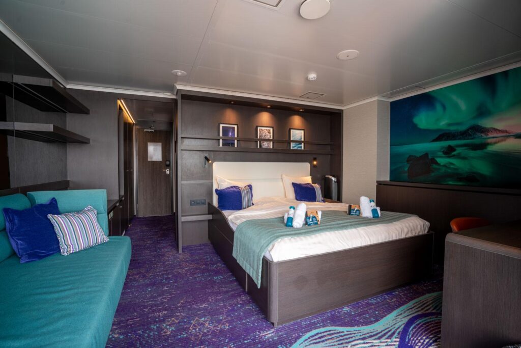
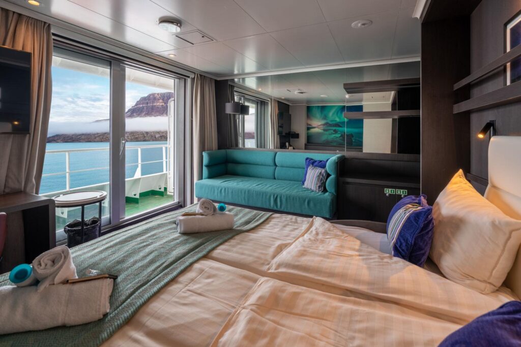
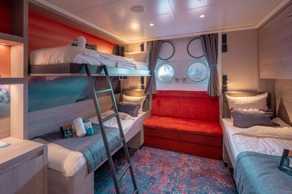
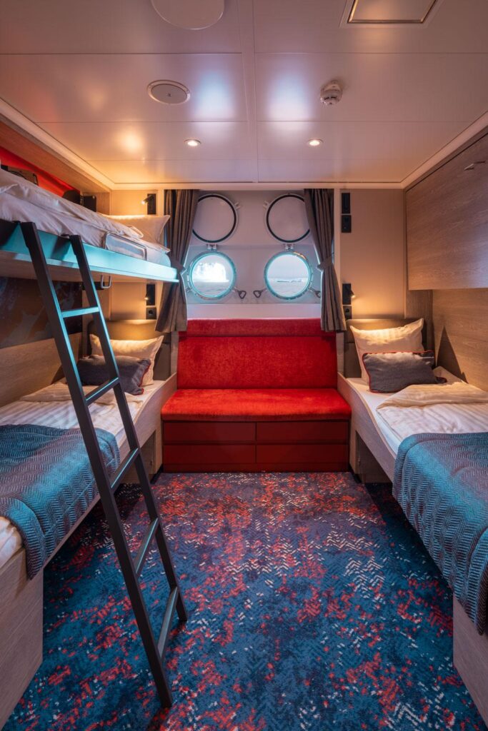
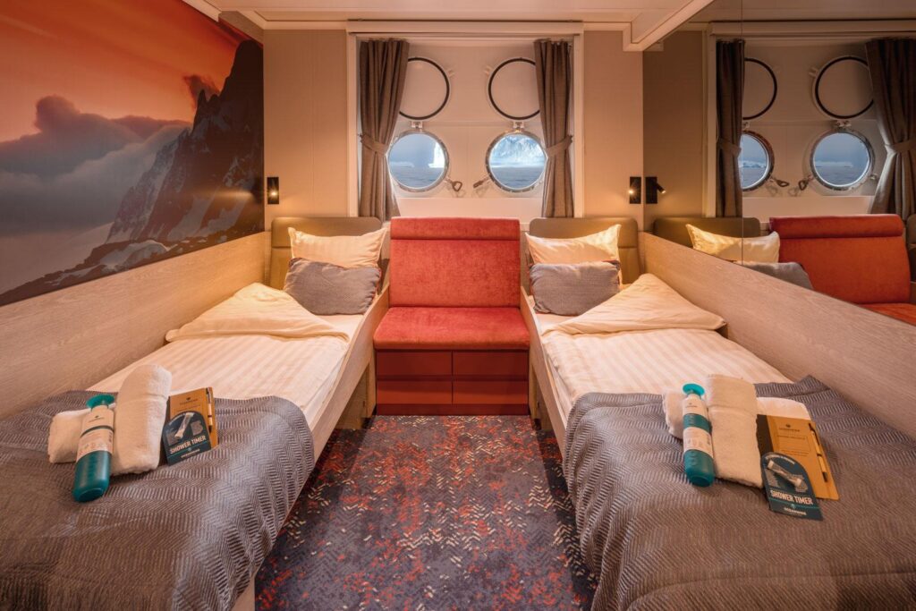
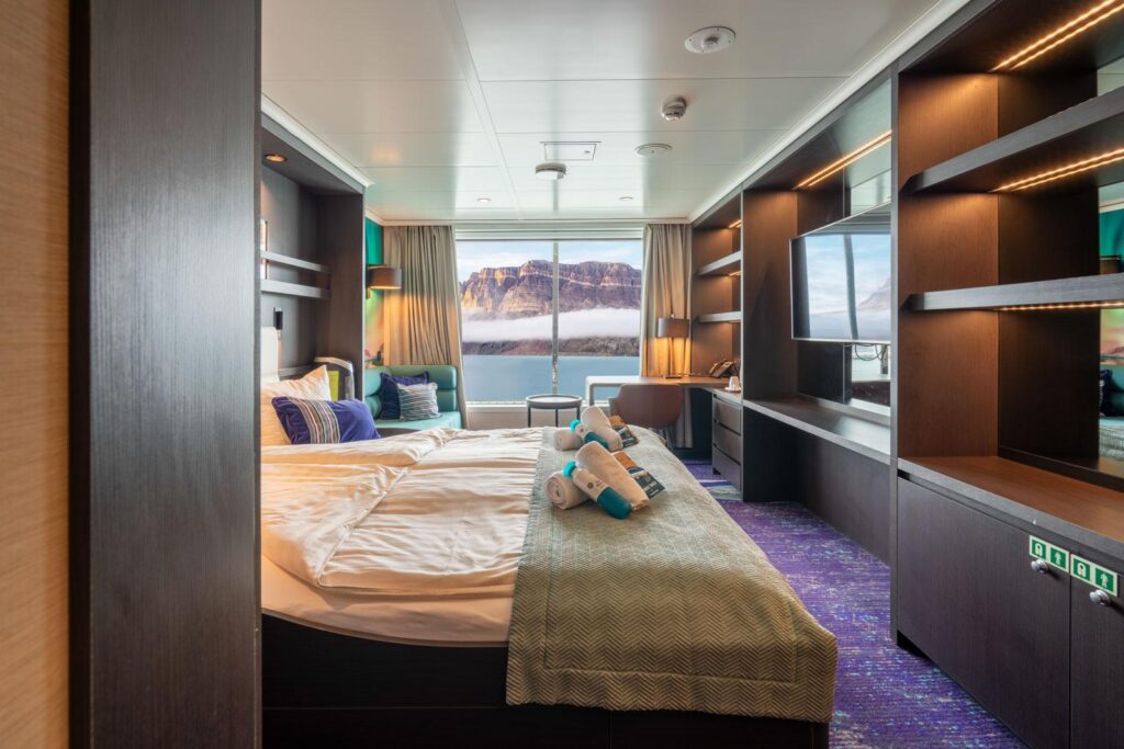
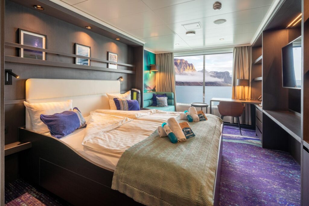
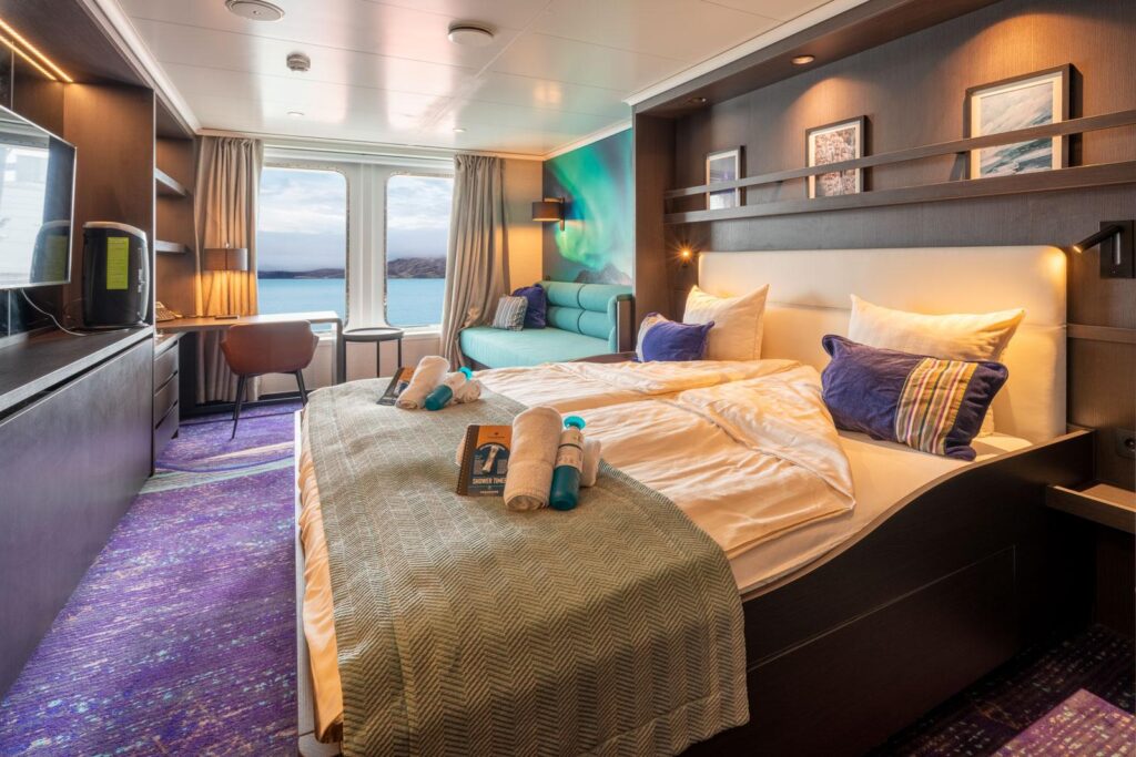
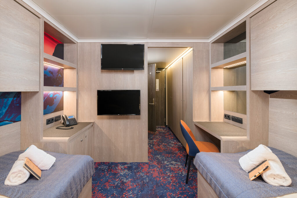
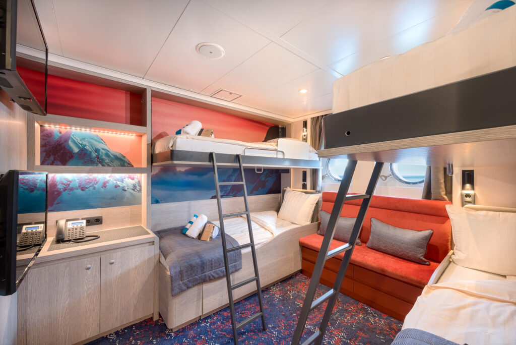
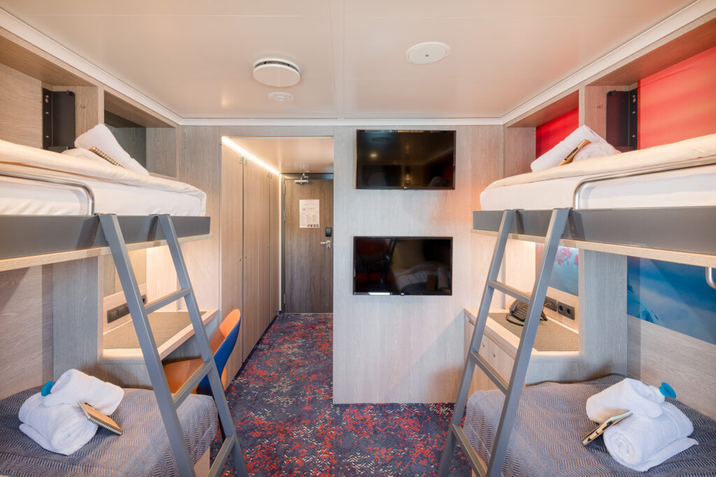
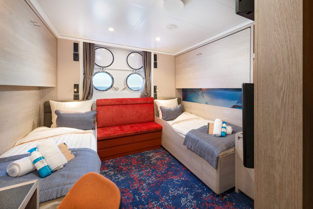
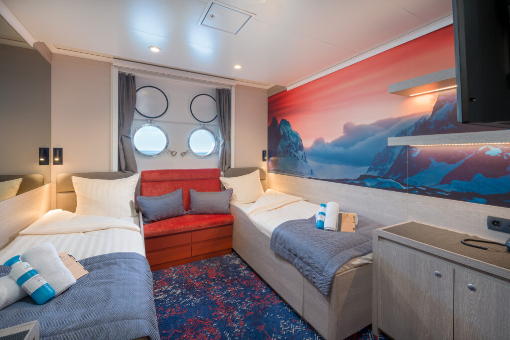
Rembrandt van Rijn Cabins
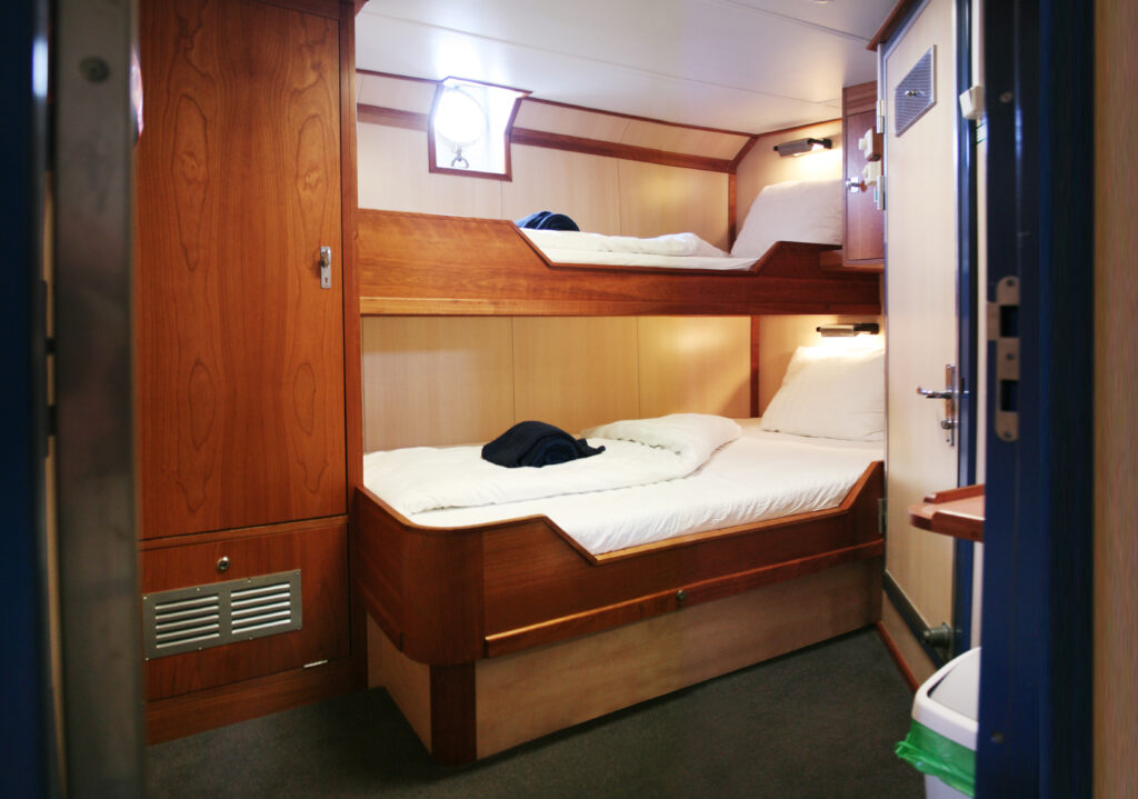
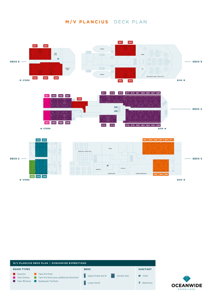
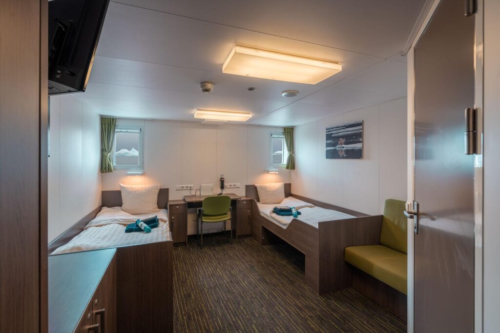
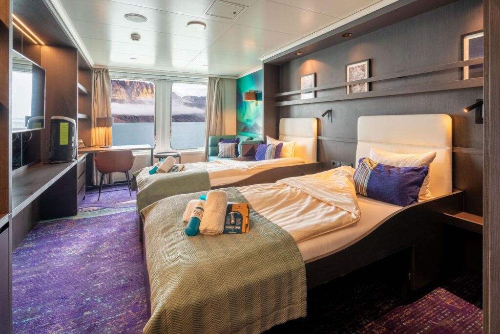
Plancius Cabins
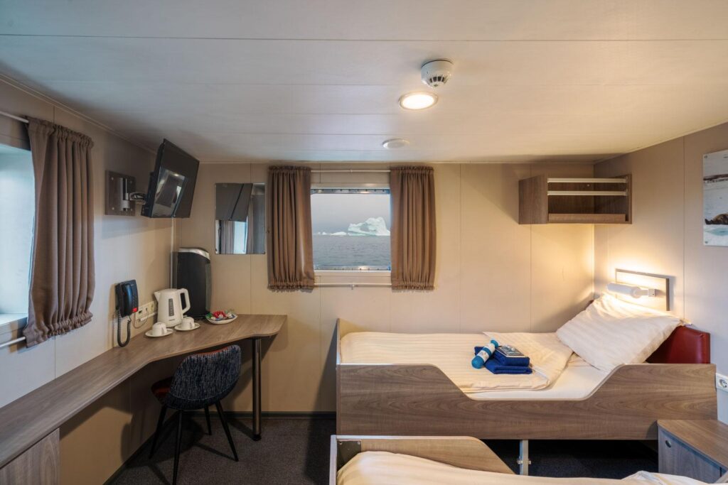
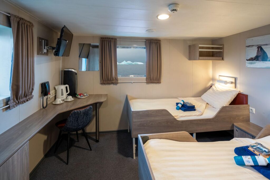
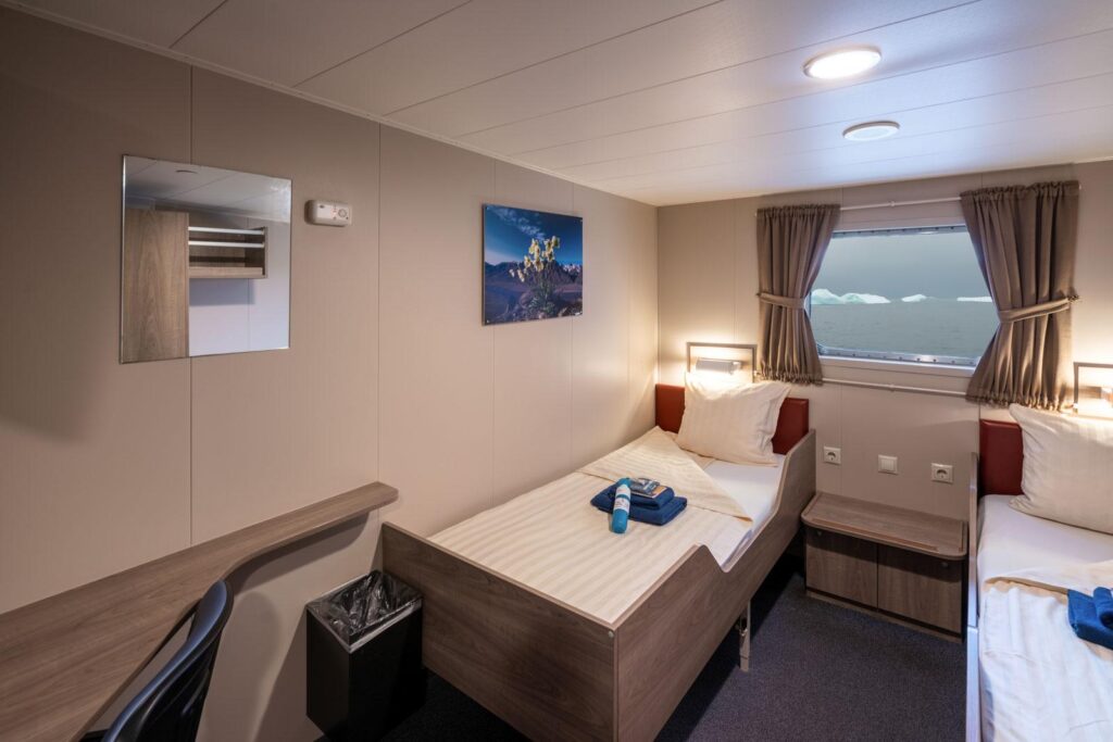
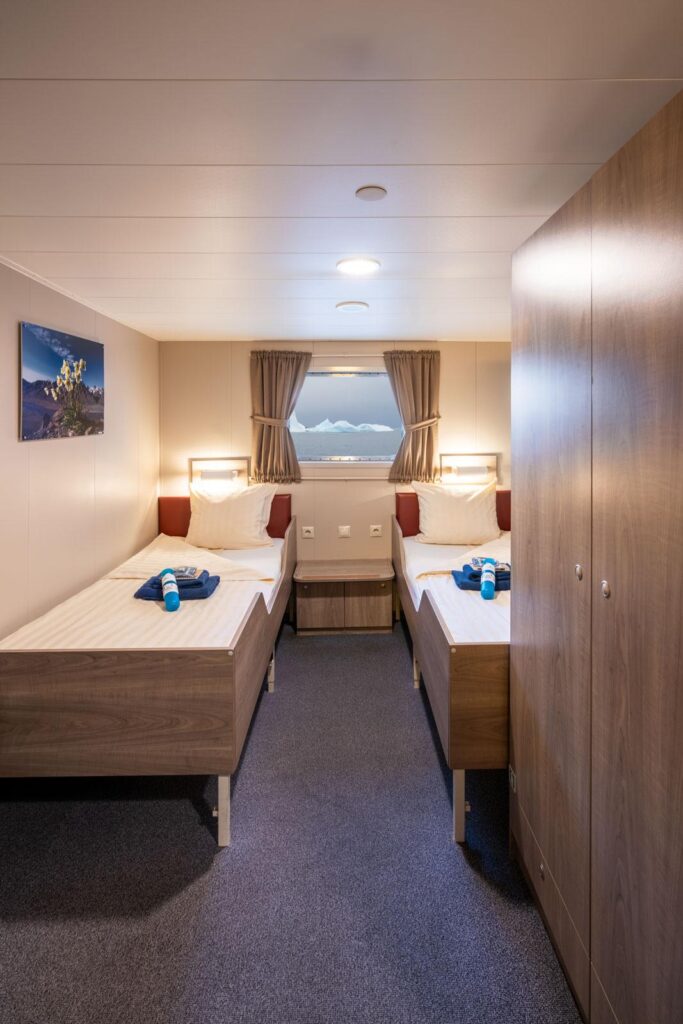
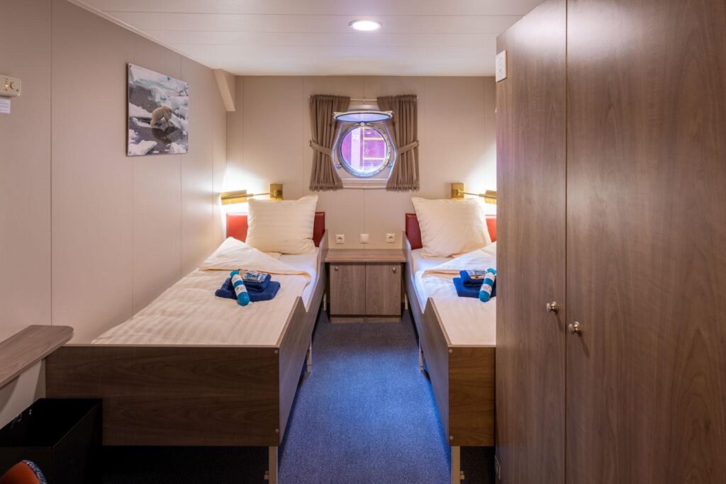
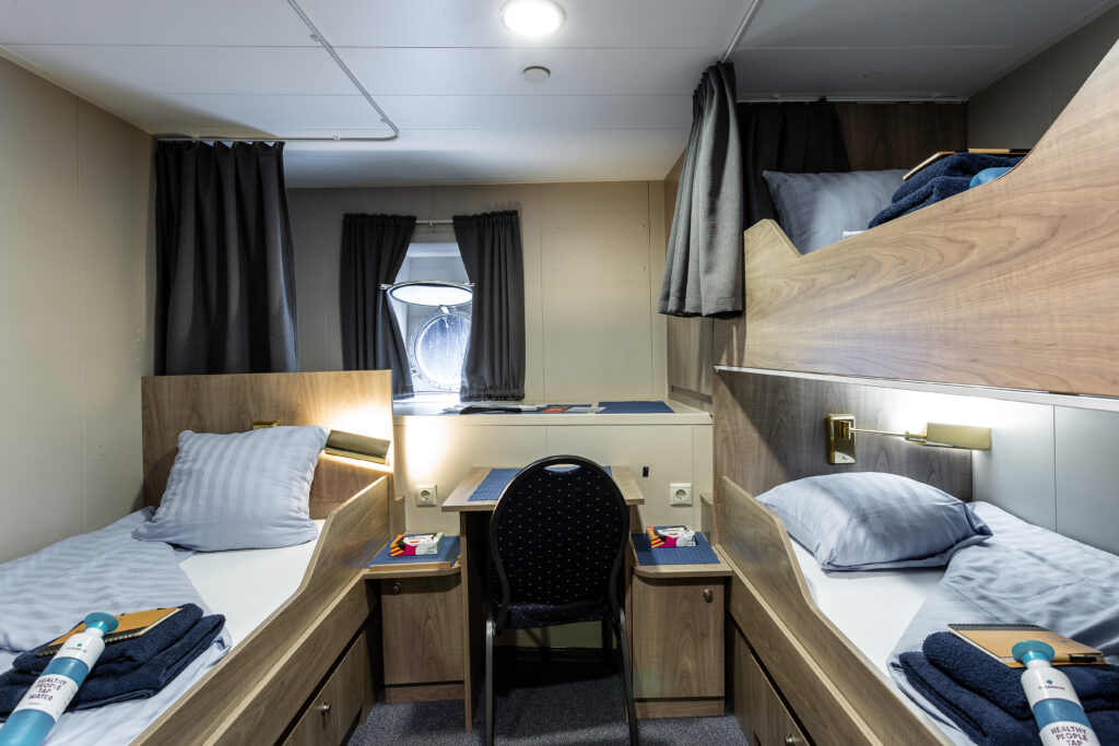
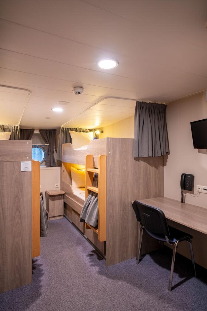
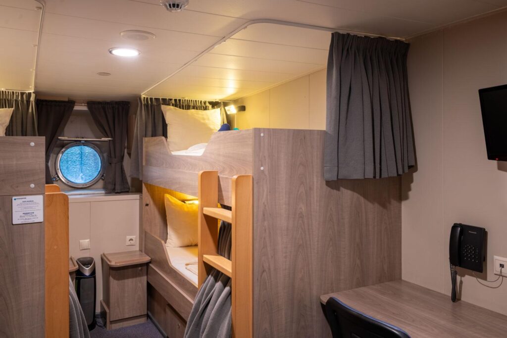
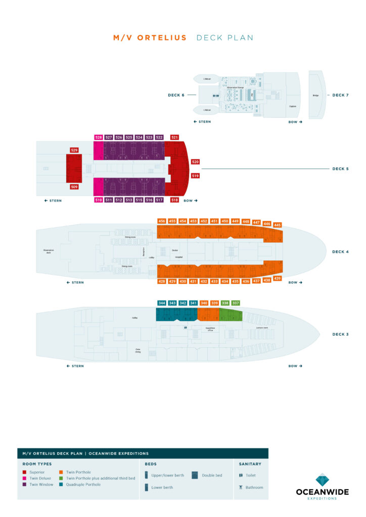
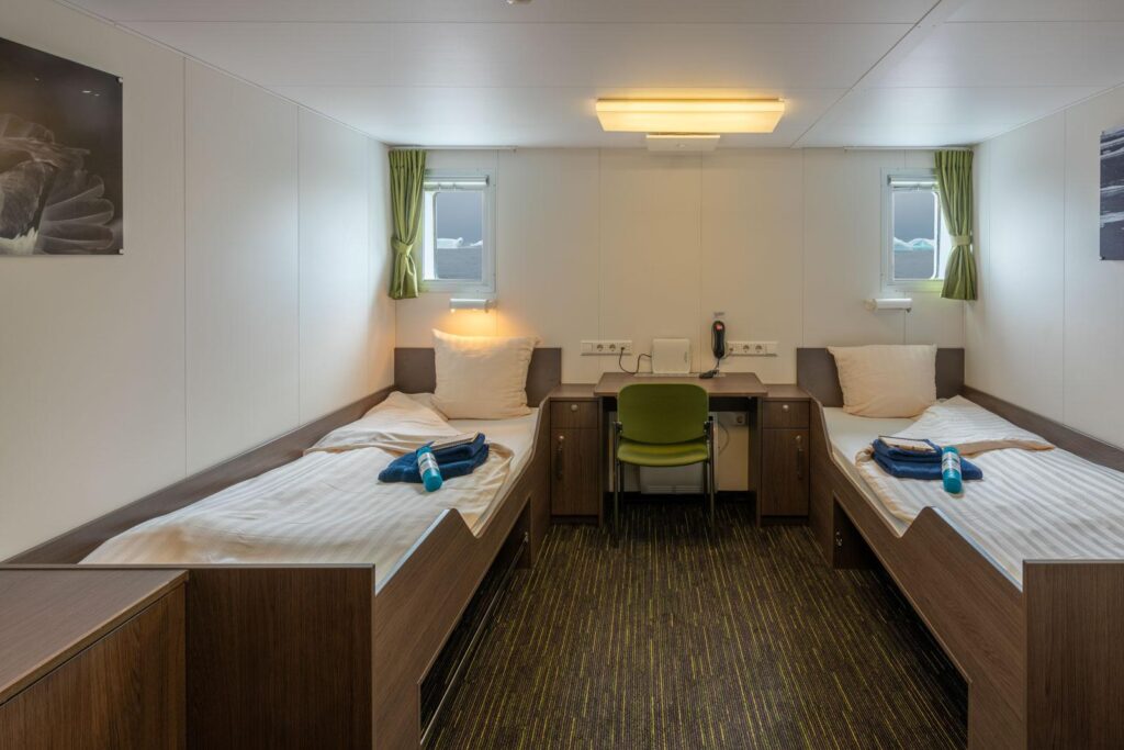
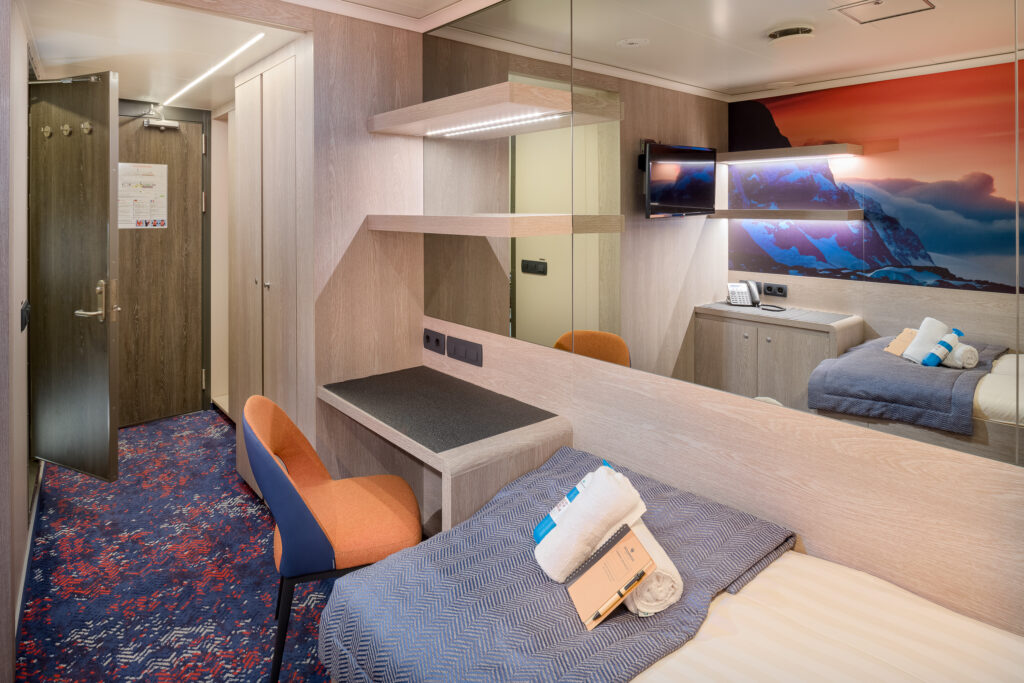
Ortelius Cabins
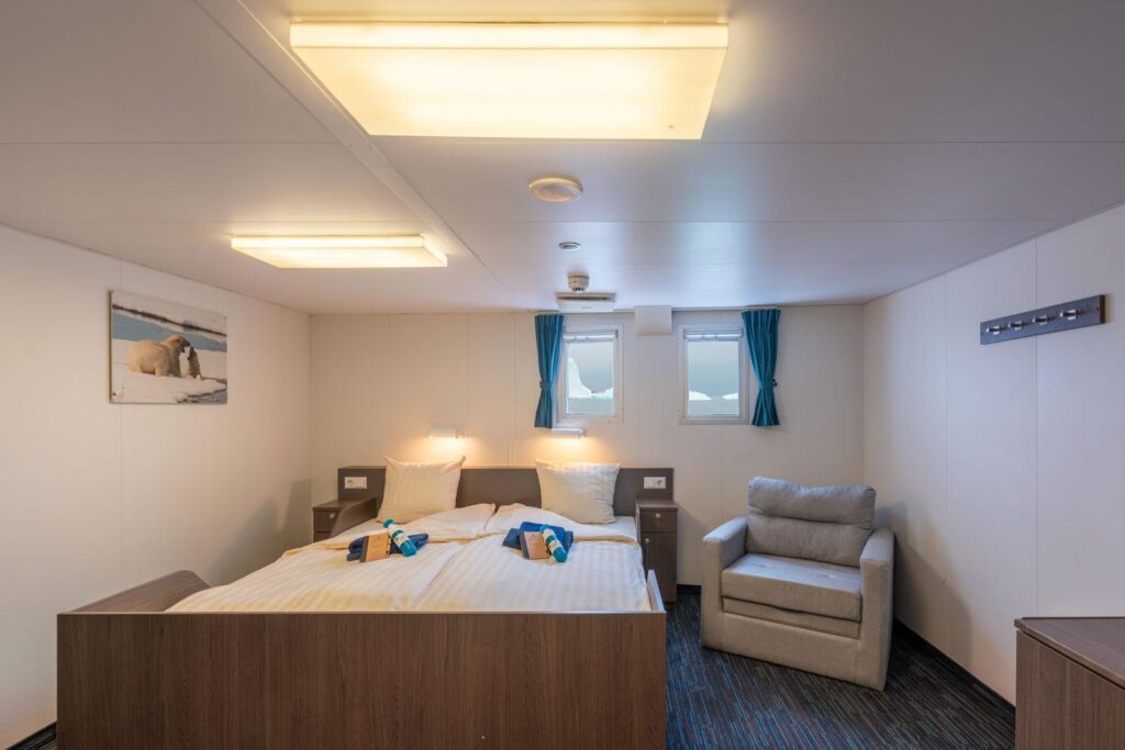
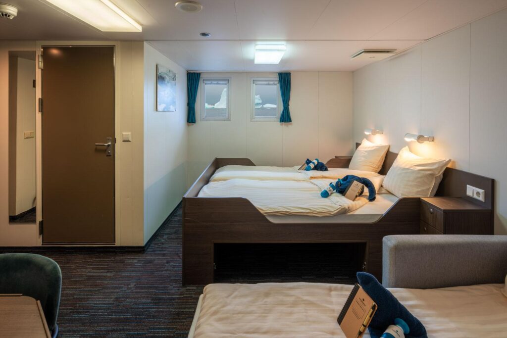
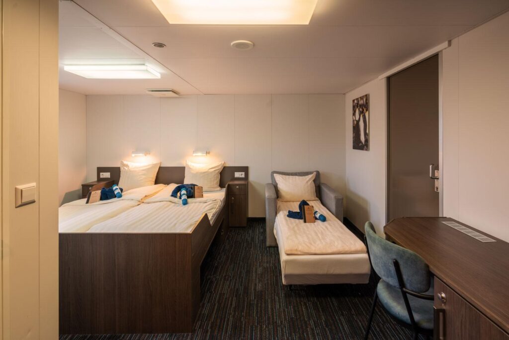
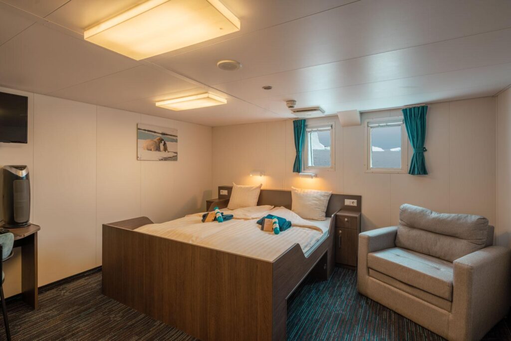
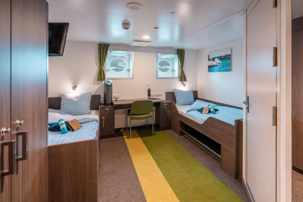
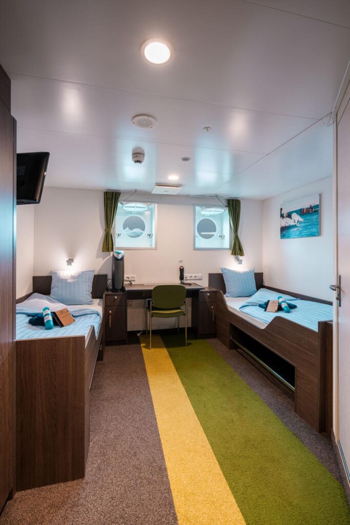
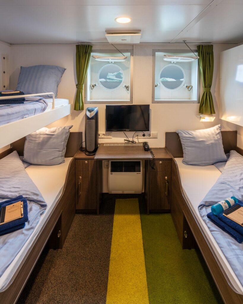
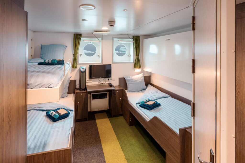
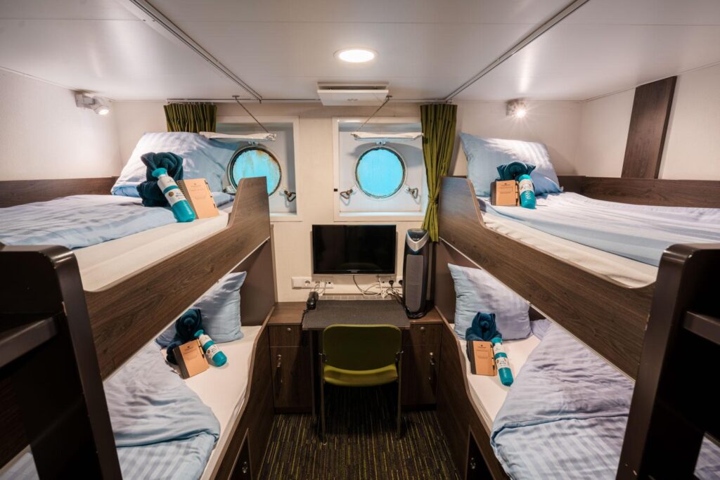
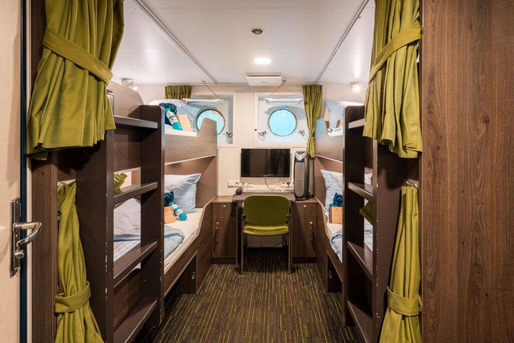
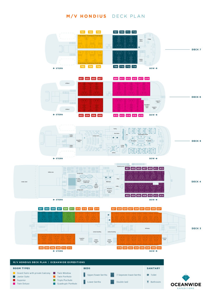
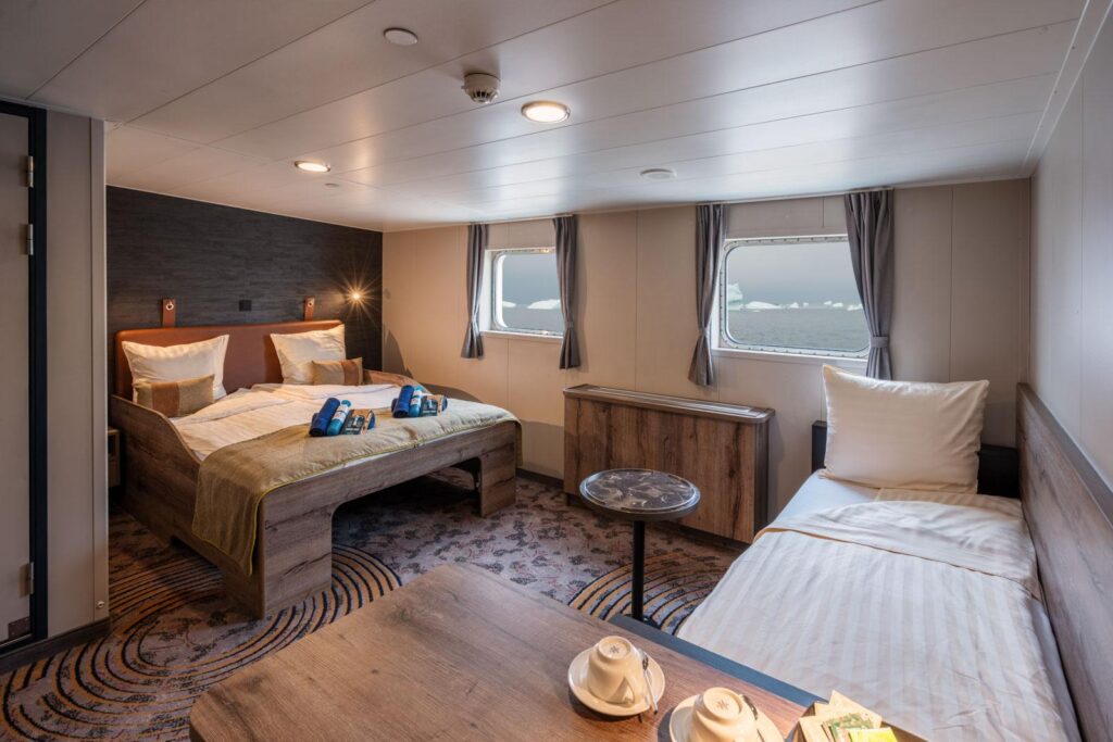
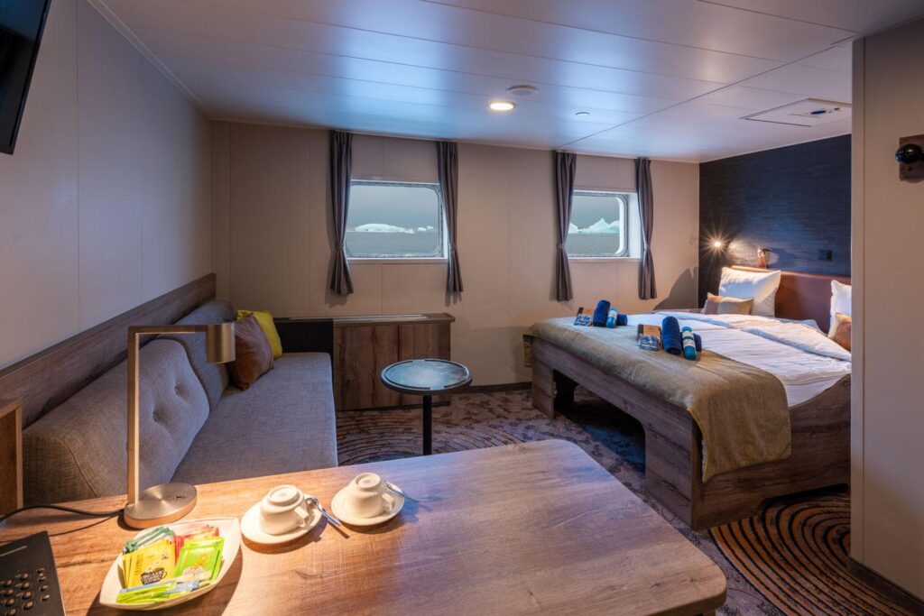
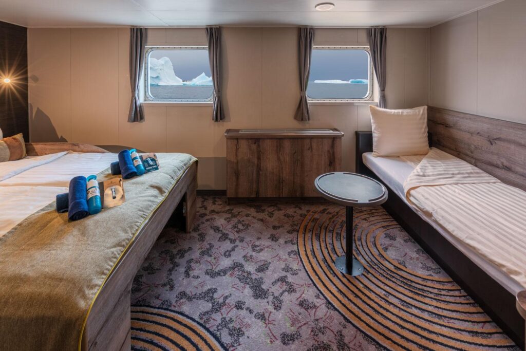
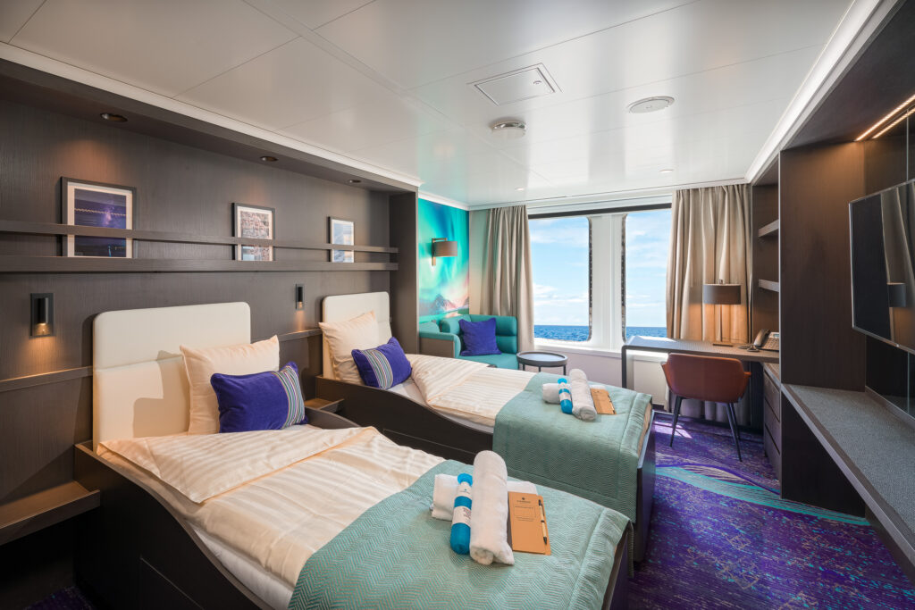
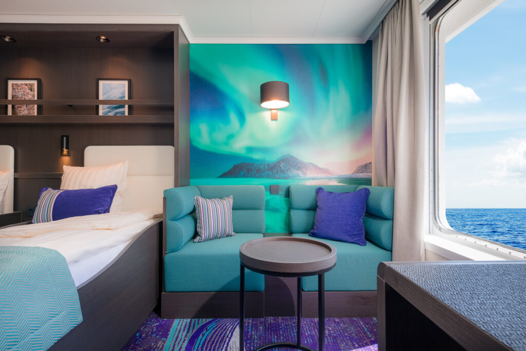
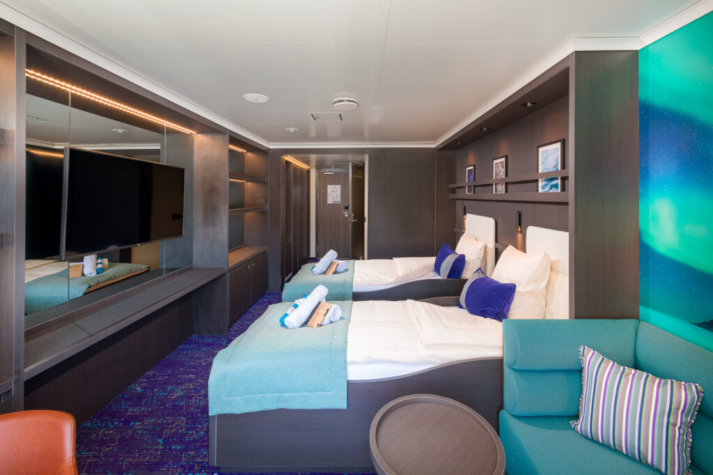
Hondius Cabins


General Facilities - Rembrandt van Rijn
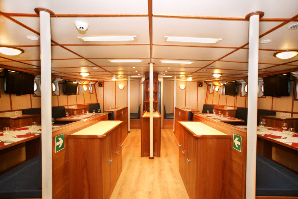
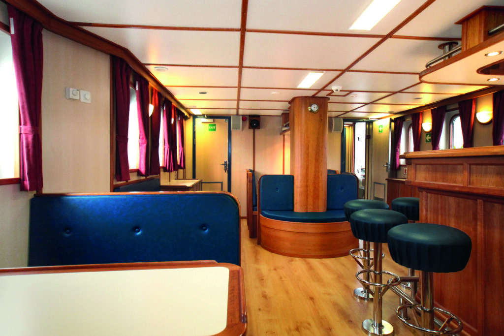
General Facilities - Plancius
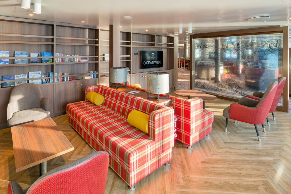
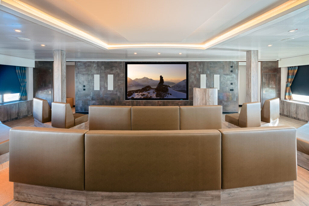
General Facilities - Ortelius